 Warner Robins
Wantagh
Bethel
Misty Hill Farm
United States
Wakonda Beach (R33) Airport
Wilmington
Poland
Miami International Airport
Warner Robins
Wantagh
Bethel
Misty Hill Farm
United States
Wakonda Beach (R33) Airport
Wilmington
Poland
Miami International Airport
Lake Havasu State Park on the map, Lake Havasu City, United States
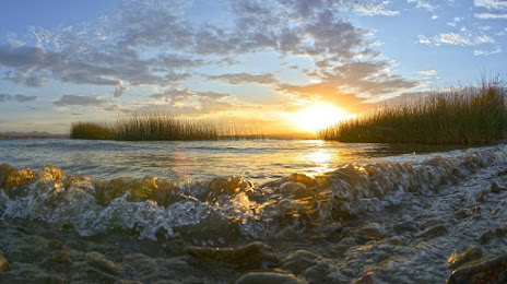
Photo
Where is located Lake Havasu State Park
Lake Havasu State Park — local attraction, which is located at 699 London Bridge Rd, Lake Havasu City, AZ 86403, United States and belongs to the category — state park. Average visitor rating for this place — 4.6 (according to 3629 ratings, information from open sources and relevant for 2022).
Exact location — Lake Havasu State Park, marked on the map with a red marker.
You can get directions to Lake Havasu State Park on the map from your location.
What else is interesting in Lake Havasu City? You can see all the sights if you go to the city page.
Coordinates
Lake Havasu State Park, United States coordinates in decimal format: latitude — 34.492289766838795, longitude — -114.36005827531842. When converted to degrees, minutes, seconds Lake Havasu State Park has the following coordinates: 34°29′32.24 north latitude and -114°21′36.21 east longitude.
Nearby cities
The largest cities that are located nearby:
- Henderson — 182 km
- Spring Valley — 198 km
- Las Vegas — 200 km
- North Las Vegas — 202 km
- Peoria — 216 km
- Glendale — 223 km
- San Luis Río Colorado
 (Mexico) — 229 km
 - Mexicali (Mexico) — 231 km
- Phoenix — 237 km
- Scottsdale — 247 km
- Tempe — 249 km
- Mesa — 258 km
- Chandler — 264 km
- Gilbert — 265 km
- Moreno Valley — 273 km
- San Bernardino — 275 km
- Rialto — 282 km
- Riverside — 288 km
- Fontana — 288 km
Distance to the capital
Distance to the capital (Washington) is about — 3341 km.