 Chillicothe
Mountainair
Hobbs
Bethesda
Denver
Portland
Baton Rouge
Livonia
Skokie
Palmer Lake
Englewood
Woodland Park
Scottsdale
Jackson
Eads
New Orleans
Colorado Springs
North Salt Lake
Salt Lake City
Chillicothe
Mountainair
Hobbs
Bethesda
Denver
Portland
Baton Rouge
Livonia
Skokie
Palmer Lake
Englewood
Woodland Park
Scottsdale
Jackson
Eads
New Orleans
Colorado Springs
North Salt Lake
Salt Lake City
Red Bluff on the map, United States
Where is located Red Bluff
Exact location — Red Bluff, Tehama County, California, United States, marked on the map with a red marker.
Coordinates
Red Bluff, United States coordinates in decimal format: latitude — 40.1784886, longitude — -122.2358302. When converted to degrees, minutes, seconds Red Bluff has the following coordinates: 40°10′42.56 north latitude and -122°14′8.99 east longitude.
Population
Red Bluff, Tehama County, California, United States, according to our data the population is — 14,036 residents, which is about 0% of the total population of the country (United States).
Comparison of the population on the graph:
Exact time
Time zone for this location Red Bluff — UTC -7 America/Los_Angeles. Exact time — wednesday, 4 april 2024 year, 07 h. 37 minutes.
Sunrise and sunset
Red Bluff, sunrise and sunset data for a date — wednesday 17.04.2024.
| Sunrise | Sunset | Day (duration) |
|---|---|---|
| 06:29 -2 minutes | 19:47 +1 minute | 13 h. 18 minutes. +3 minutes |
You can control the scale of the map using the auxiliary tools to find out exactly where it is located Red Bluff. When you change the scale of the map, the width of the ruler also changes (in kilometers and miles).
Nearby cities
The largest cities that are located nearby:
- Roseville — 178 km
- Sacramento — 188 km
- Santa Rosa — 197 km
- Fairfield — 214 km
- Reno — 219 km
- Vallejo — 229 km
- Concord — 244 km
- Richmond — 251 km
- Berkeley — 255 km
- Stockton — 259 km
- Oakland — 263 km
- San Francisco — 266 km
- Hayward — 278 km
- Fremont — 292 km
- Modesto — 301 km
- Sunnyvale — 311 km
- Santa Clara — 313 km
- San Jose — 316 km
- Salinas — 390 km
Distance to neighboring capitals:
- Mexico City
 (Mexico) — 3189 km
 - Ottawa
 (Canada) — 3789 km
 - Belmopan
 (Belize) — 4101 km
 - Guatemala City
 (Guatemala) — 4187 km
 - Nuuk
 (Greenland) — 5141 km
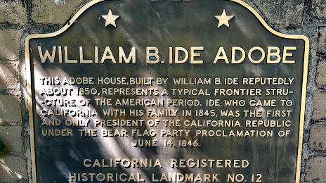
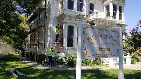
Attractions

Distance to the capital
Distance to the capital (Washington) is about — 3837 km.