 Danbury
Guilford
East Rutherford
Milford
Seymour
West Haven
Ronkonkoma
Commack
Zionsville
Napoleon Airport
Goshen
Hillsdale
Ukiah
Fort Washington
Santa Rosa
Branchville
Honey Brook
Winchester
Doylestown
Danbury
Guilford
East Rutherford
Milford
Seymour
West Haven
Ronkonkoma
Commack
Zionsville
Napoleon Airport
Goshen
Hillsdale
Ukiah
Fort Washington
Santa Rosa
Branchville
Honey Brook
Winchester
Doylestown
Defiance on the map, United States
Where is located Defiance
Exact location — Defiance, Defiance County, Ohio, United States, marked on the map with a red marker.
Coordinates
Defiance, United States coordinates in decimal format: latitude — 41.2844933, longitude — -84.3557802. When converted to degrees, minutes, seconds Defiance has the following coordinates: 41°17′4.18 north latitude and -84°21′20.81 east longitude.
Population
Defiance, Defiance County, Ohio, United States, according to our data the population is — 15,926 residents, which is about 0% of the total population of the country (United States).
Comparison of the population on the graph:
Exact time
Time zone for this location Defiance — UTC -4 America/New_York. Exact time — thursday, 4 april 2024 year, 18 h. 18 minutes.
Sunrise and sunset
Defiance, sunrise and sunset data for a date — thursday 25.04.2024.
| Sunrise | Sunset | Day (duration) |
|---|---|---|
| 06:45 -1 minute | 20:25 +1 minute | 13 h. 42 minutes. +2 minutes |
You can control the scale of the map using the auxiliary tools to find out exactly where it is located Defiance. When you change the scale of the map, the width of the ruler also changes (in kilometers and miles).
Nearby cities
The largest cities that are located nearby:
- Fort Wayne — 69 km
- Toledo — 78 km
- Ann Arbor — 121 km
- Windsor
 (Canada) — 157 km
 - Springfield — 157 km
- Detroit — 158 km
- Lansing — 161 km
- South Bend — 162 km
- Warren — 174 km
- Sterling Heights — 179 km
- Columbus — 186 km
- Flint — 199 km
- Grand Rapids — 214 km
- Cleveland — 222 km
- Indianapolis — 227 km
- Akron — 237 km
- Cincinnati — 242 km
- Aurora — 250 km
- Chicago — 277 km
Distance to neighboring capitals:
- Ottawa (Canada) — 837 km
- Belmopan
 (Belize) — 2706 km
 - Mexico City
 (Mexico) — 2805 km
 - Guatemala City
 (Guatemala) — 3026 km
 - Nuuk
 (Greenland) — 3291 km
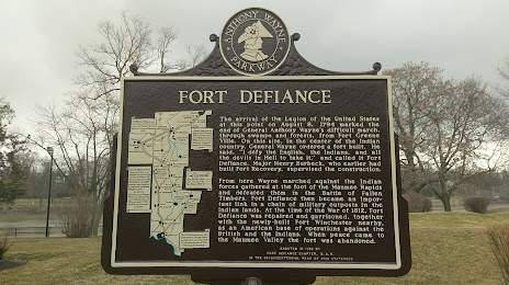
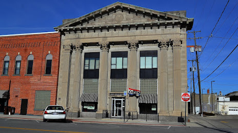
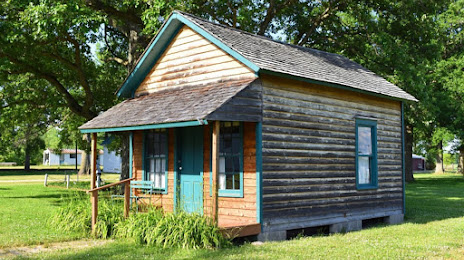
Attractions

Distance to the capital
Distance to the capital (Washington) is about — 676 km.