 Bad Axe
Northville
Roseville
Cass City
Rochester
Pontiac
New Baltimore
Alpine
Minden City
Baraboo
Stoughton
Rothschild
Wausau
Geyserville
Lodi
Beloit
Neillsville
Sun Prairie
Marshfield
Bad Axe
Northville
Roseville
Cass City
Rochester
Pontiac
New Baltimore
Alpine
Minden City
Baraboo
Stoughton
Rothschild
Wausau
Geyserville
Lodi
Beloit
Neillsville
Sun Prairie
Marshfield
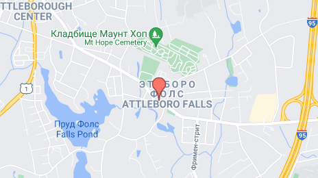
Attleboro on the map, United States
Where is located Attleboro
Exact location — Attleboro, Bristol County, Massachusetts, United States, marked on the map with a red marker.
Coordinates
Attleboro, United States coordinates in decimal format: latitude — 41.9445441, longitude — -71.2856082. When converted to degrees, minutes, seconds Attleboro has the following coordinates: 41°56′40.36 north latitude and -71°17′8.19 east longitude.
Population
Attleboro, Bristol County, Massachusetts, United States, according to our data the population is — 44,271 residents, which is about 0% of the total population of the country (United States).
Comparison of the population on the graph:
Exact time
Time zone for this location Attleboro — UTC -4 America/New_York. Exact time — tuesday, 4 april 2024 year, 12 h. 51 minute.
Sunrise and sunset
Attleboro, sunrise and sunset data for a date — tuesday 16.04.2024.
| Sunrise | Sunset | Day (duration) |
|---|---|---|
| 06:05 -1 minute | 19:24 +1 minute | 13 h. 18 minutes. +2 minutes |
You can control the scale of the map using the auxiliary tools to find out exactly where it is located Attleboro. When you change the scale of the map, the width of the ruler also changes (in kilometers and miles).
Nearby cities
The largest cities that are located nearby:
- Providence — 17 km
- Boston — 50 km
- Cambridge — 50 km
- Worcester — 55 km
- Lowell — 76 km
- Amherst — 108 km
- Springfield — 108 km
- Manchester — 117 km
- Hartford — 117 km
- Waterbury — 152 km
- New Haven — 153 km
- Bridgeport — 180 km
- Stamford — 212 km
- Yonkers — 245 km
- New York — 266 km
- Brooklyn — 266 km
- Paterson — 267 km
- Newark — 276 km
- Elizabeth — 283 km
Distance to neighboring capitals:
- Ottawa
 (Canada) — 525 km
 - Nuuk
 (Greenland) — 2770 km
 - Belmopan
 (Belize) — 3211 km
 - Guatemala City
 (Guatemala) — 3558 km
 - Mexico City
 (Mexico) — 3625 km
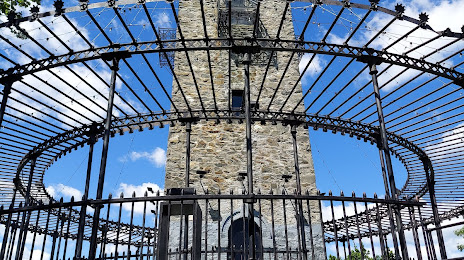
Attractions


Distance to the capital
Distance to the capital (Washington) is about — 592 km.