 The hope
Izabal
Retalhuleu
Santa Cruz La Laguna
Tekpan
Santa Cruz la Laguna
Monterrico
Flores
Totonicapan
Guatemala
Guatemala
Guatemala
Guatemala
Livingston
San Sebastián
Uspantan
Colomba
Chinique
Cuyotenango
The hope
Izabal
Retalhuleu
Santa Cruz La Laguna
Tekpan
Santa Cruz la Laguna
Monterrico
Flores
Totonicapan
Guatemala
Guatemala
Guatemala
Guatemala
Livingston
San Sebastián
Uspantan
Colomba
Chinique
Cuyotenango
Chiquimula on the map, Guatemala
Where is located Chiquimula
Exact location — Chiquimula, Department of Chiquimula, Guatemala, marked on the map with a red marker.
Coordinates
Chiquimula, Guatemala coordinates in decimal format: latitude — 14.7924897, longitude — -89.5450458. When converted to degrees, minutes, seconds Chiquimula has the following coordinates: 14°47′32.96 north latitude and -89°32′42.16 east longitude.
Population
Chiquimula, Department of Chiquimula, Guatemala, according to our data the population is — 41,521 residents, which is about 0.2% of the total population of the country (Guatemala).
Comparison of the population on the graph:
Exact time
Time zone for this location Chiquimula — UTC -6 America/Guatemala. Exact time — thursday, 4 april 2024 year, 17 h. 42 minutes.
Sunrise and sunset
Chiquimula, sunrise and sunset data for a date — thursday 25.04.2024.
| Sunrise | Sunset | Day (duration) |
|---|---|---|
| 05:40 -0 minutes | 18:11 -0 minutes | 12 h. 30 minutes. -0 minutes |
You can control the scale of the map using the auxiliary tools to find out exactly where it is located Chiquimula. When you change the scale of the map, the width of the ruler also changes (in kilometers and miles).
Nearby cities
The largest cities that are located nearby:
- Santa Ana
 (El Salvador) — 90 km
 - Villa Canales — 109 km
- Villa Nueva — 115 km
- Apopa (El Salvador) — 116 km
- San Juan Sacatepéquez — 118 km
- Mejicanos (El Salvador) — 122 km
- Santa Tecla (El Salvador) — 126 km
- San Salvador (El Salvador) — 127 km
- Soyapango (El Salvador) — 127 km
- Escuintla — 144 km
- San Pedro Sula
 (Honduras) — 179 km
 - Choloma (Honduras) — 192 km
- El Progreso (Honduras) — 198 km
- San Miguel (El Salvador) — 207 km
- Quetzaltenango — 211 km
- Tegucigalpa (Honduras) — 262 km
- Tapachula
 (Mexico) — 291 km
 - La Ceiba (Honduras) — 308 km
- Chinandega
 (Nicaragua) — 354 km
Distance to neighboring capitals:
- San Salvador (El Salvador) — 127 km
- Tegucigalpa (Honduras) — 263 km
- Belmopan
 (Belize) — 286 km
 - Managua (Nicaragua) — 463 km
- Mexico City (Mexico) — 1142 km
- Washington
 (United States) — 2948 km
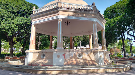
Attractions
Distance to the capital
Distance to the capital (Guatemala City) is about — 108 km.