 San Pablo Guelatao
Zimatlán de Álvarez
Ayoquezco de Aldama
San Andrés Sinaxtla
Mariscala de Juárez
Playa de Chachalacas
Buenavista
Hidalgo
Mezquite
Las Pintitas
A Nicolás Bravo
General Alberto Pineda
El Otatal
Tonalá
Gustavo López Gutiérrez
Topón
Tamazula
Maneadero
Colonia Benito García
San Pablo Guelatao
Zimatlán de Álvarez
Ayoquezco de Aldama
San Andrés Sinaxtla
Mariscala de Juárez
Playa de Chachalacas
Buenavista
Hidalgo
Mezquite
Las Pintitas
A Nicolás Bravo
General Alberto Pineda
El Otatal
Tonalá
Gustavo López Gutiérrez
Topón
Tamazula
Maneadero
Colonia Benito García
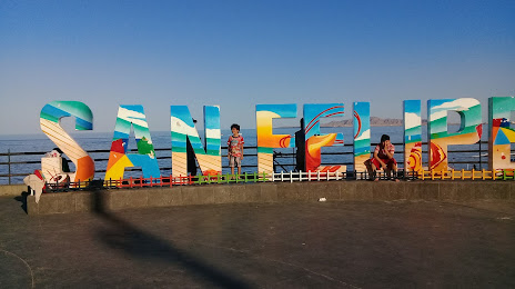
San Felipe on the map, Mexico
Where is located San Felipe
Exact location — San Felipe, Baja California, Mexico, marked on the map with a red marker.
Coordinates
San Felipe, Mexico coordinates in decimal format: latitude — 31.0250709, longitude — -114.8407776. When converted to degrees, minutes, seconds San Felipe has the following coordinates: 31°1′30.26 north latitude and -114°50′26.8 east longitude.
Population
San Felipe, Baja California, Mexico, according to our data the population is — 15,386 residents, which is about 0% of the total population of the country (Mexico).
Comparison of the population on the graph:
Exact time
Time zone for this location San Felipe — UTC -7 America/Tijuana. Exact time — thursday, 4 april 2024 year, 16 h. 52 minutes.
Sunrise and sunset
San Felipe, sunrise and sunset data for a date — thursday 25.04.2024.
| Sunrise | Sunset | Day (duration) |
|---|---|---|
| 06:02 -1 minute | 19:11 -0 minutes | 13 h. 12 minutes. +1 minute |
You can control the scale of the map using the auxiliary tools to find out exactly where it is located San Felipe. When you change the scale of the map, the width of the ruler also changes (in kilometers and miles).
Nearby cities
The largest cities that are located nearby:
- San Luis Río Colorado — 158 km
- Mexicali — 186 km
- Ensenada — 190 km
- Tijuana — 263 km
- Chula Vista
 (United States) — 275 km
 - San Diego (United States) — 286 km
- Escondido (United States) — 311 km
- Oceanside (United States) — 336 km
- Phoenix (United States) — 370 km
- Glendale (United States) — 370 km
- Nogales (United States) — 371 km
- Peoria (United States) — 371 km
- Chandler (United States) — 375 km
- Tempe (United States) — 377 km
- Gilbert (United States) — 382 km
- Scottsdale (United States) — 383 km
- Mesa (United States) — 383 km
- Tucson (United States) — 389 km
- Moreno Valley (United States) — 390 km
Distance to neighboring capitals:
- Belmopan
 (Belize) — 3046 km
 - Guatemala City
 (Guatemala) — 3076 km
 - Tegucigalpa
 (Honduras) — 3390 km
 - Washington (United States) — 3529 km
- Ottawa
 (Canada) — 3729 km
 - Saint John
 (Puerto Rico) — 5075 km
 - Hagåtña
 (Guam) — 10205 km
 - Belgrade
 (Serbia) — 10451 km
 - Podgorica
 (Montenegro) — 10599 km
Attractions
Distance to the capital
Distance to the capital (Mexico City) is about — 2035 km.