
 Cáqueza
Vichada
Fusagasugá
Monos
Velez
El Carmen
La Peña
Isabel Lopez
San Eduardo
Heliconia
El Playón
Berbeo
Villa Hermosa
El Carmelo
Pueblo Nuevo
Vereda El Canada
Caldas
Papayal
Tarra
Cáqueza
Vichada
Fusagasugá
Monos
Velez
El Carmen
La Peña
Isabel Lopez
San Eduardo
Heliconia
El Playón
Berbeo
Villa Hermosa
El Carmelo
Pueblo Nuevo
Vereda El Canada
Caldas
Papayal
Tarra
Honda on the map, Colombia
Where is located Honda
Exact location — Honda, Honda, Tolima, Colombia, marked on the map with a red marker.
Coordinates
Honda, Colombia coordinates in decimal format: latitude — 5.205118, longitude — -74.737081. When converted to degrees, minutes, seconds Honda has the following coordinates: 5°12′18.42 north latitude and -74°44′13.49 east longitude.
Population
Honda, Honda, Tolima, Colombia, according to our data the population is — 28,158 residents, which is about 0.1% of the total population of the country (Colombia).
Comparison of the population on the graph:
Exact time
Time zone for this location Honda — UTC -5 America/Bogota. Exact time — wednesday, 4 april 2024 year, 23 h. 54 minutes.
Sunrise and sunset
Honda, sunrise and sunset data for a date — wednesday 24.04.2024.
| Sunrise | Sunset | Day (duration) |
|---|---|---|
| 05:50 -1 minute | 18:02 -1 minute | 12 h. 12 minutes. -0 minutes |
You can control the scale of the map using the auxiliary tools to find out exactly where it is located Honda. When you change the scale of the map, the width of the ruler also changes (in kilometers and miles).
Nearby cities
The largest cities that are located nearby:
- Manizales — 87 km
- Soacha — 89 km
- Girardot — 101 km
- Ibagué — 101 km
- Dos Quebradas — 110 km
- Pereira — 114 km
- Armenia — 127 km
- Cartago — 139 km
- Envigado — 143 km
- Itagüi — 144 km
- Medellín — 149 km
- Bello — 154 km
- Tunja — 158 km
- Villavicencio — 170 km
- Tuluá — 203 km
- Sogamoso — 207 km
- Buga — 225 km
- Barrancabermeja — 227 km
- Palmira — 253 km
Distance to neighboring capitals:
- Panama
 (Panama) — 674 km
 - Quito
 (Ecuador) — 728 km
 - Caracas
 (Venezuela) — 1043 km
 - San Jose
 (Costa Rica) — 1157 km
 - Georgetown
 (Guyana) — 1841 km
 - Nuestra Señora de La Paz
 (Bolivia) — 2521 km
 - Asuncion
 (Paraguay) — 3863 km
 - Santiago
 (Chile) — 4320 km
 - Buenos Aires
 (Argentina) — 4748 km
 - Montevideo
 (Uruguay) — 4867 km
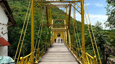
Attractions

Distance to the capital
Distance to the capital (Bogota) is about — 100 km.