 Aix
Tambo
Clinton
Pitcairn
Hot Springs
Fontana-on-Geneva Lake
Watertown
Nikolai
The Pinery
Long County
Kirk
Old Harbor
Whitefish Point
Elton
Sackets Harbor
Hope
Fleming County
Barber County
Luverne
Aix
Tambo
Clinton
Pitcairn
Hot Springs
Fontana-on-Geneva Lake
Watertown
Nikolai
The Pinery
Long County
Kirk
Old Harbor
Whitefish Point
Elton
Sackets Harbor
Hope
Fleming County
Barber County
Luverne
Saint Peter on the map, United States
Where is located Saint Peter
Exact location — Saint Peter, Nicollet County, Minnesota, United States, marked on the map with a red marker.
Coordinates
Saint Peter, United States coordinates in decimal format: latitude — 44.3258932, longitude — -93.955691. When converted to degrees, minutes, seconds Saint Peter has the following coordinates: 44°19′33.22 north latitude and -93°57′20.49 east longitude.
Population
Saint Peter, Nicollet County, Minnesota, United States, according to our data the population is — 11,196 residents, which is about 0% of the total population of the country (United States).
Comparison of the population on the graph:
Exact time
Time zone for this location Saint Peter — UTC -5 America/Chicago. Exact time — saturday, 4 april 2024 year, 05 h. 17 minutes.
Sunrise and sunset
Saint Peter, sunrise and sunset data for a date — saturday 20.04.2024.
| Sunrise | Sunset | Day (duration) |
|---|---|---|
| 06:25 -2 minutes | 20:03 +1 minute | 13 h. 36 minutes. +3 minutes |
You can control the scale of the map using the auxiliary tools to find out exactly where it is located Saint Peter. When you change the scale of the map, the width of the ruler also changes (in kilometers and miles).
Nearby cities
The largest cities that are located nearby:
- Minneapolis — 90 km
- Saint Paul — 97 km
- Sioux Falls — 239 km
- Des Moines — 303 km
- Omaha — 380 km
- Madison — 393 km
- Lincoln — 449 km
- Rockford — 458 km
- Green Bay — 468 km
- Milwaukee — 509 km
- Peoria — 543 km
- Aurora — 544 km
- Naperville — 557 km
- North Kansas City — 575 km
- Joliet — 576 km
- Independence — 580 km
- Kansas City — 580 km
- Chicago — 587 km
- Overland Park — 594 km
Distance to neighboring capitals:
- Ottawa
 (Canada) — 1441 km
 - Mexico City
 (Mexico) — 2810 km
 - Belmopan
 (Belize) — 3050 km
 - Guatemala City
 (Guatemala) — 3321 km
 - Nuuk
 (Greenland) — 3416 km
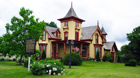
Attractions


Distance to the capital
Distance to the capital (Washington) is about — 1527 km.