 Rancho De Aereo
Tiflis
Moore Army Air Field
La France
Arctic
University Park
Ozan
Crafton
Oxford County
Grant
Lando
Bean Station
Giles County
Arredondo
Geraldine
Centerville
Brookings
Menno
Saint Peter
Rancho De Aereo
Tiflis
Moore Army Air Field
La France
Arctic
University Park
Ozan
Crafton
Oxford County
Grant
Lando
Bean Station
Giles County
Arredondo
Geraldine
Centerville
Brookings
Menno
Saint Peter
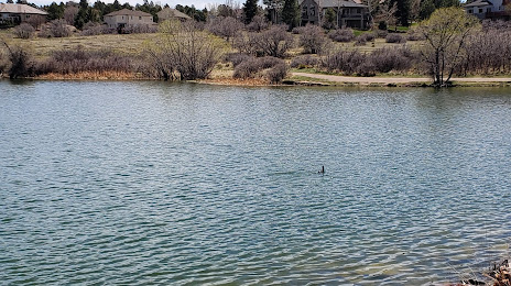
The Pinery on the map, United States
Where is located The Pinery
Exact location — The Pinery, Douglas County, Colorado, United States, marked on the map with a red marker.
Coordinates
The Pinery, United States coordinates in decimal format: latitude — 39.4552671, longitude — -104.7344187. When converted to degrees, minutes, seconds The Pinery has the following coordinates: 39°27′18.96 north latitude and -104°44′3.91 east longitude.
Population
The Pinery, Douglas County, Colorado, United States, according to our data the population is — 10,517 residents, which is about 0% of the total population of the country (United States).
Comparison of the population on the graph:
Exact time
Time zone for this location The Pinery — UTC -6 America/Denver. Exact time — wednesday, 4 april 2024 year, 23 h. 20 minutes.
Sunrise and sunset
The Pinery, sunrise and sunset data for a date — wednesday 24.04.2024.
| Sunrise | Sunset | Day (duration) |
|---|---|---|
| 06:10 -2 minutes | 19:42 +1 minute | 13 h. 30 minutes. +3 minutes |
You can control the scale of the map using the auxiliary tools to find out exactly where it is located The Pinery. When you change the scale of the map, the width of the ruler also changes (in kilometers and miles).
Nearby cities
The largest cities that are located nearby:
- Aurora — 31 km
- Denver — 38 km
- Lakewood — 40 km
- Arvada — 49 km
- Westminster — 49 km
- Thornton — 50 km
- Colorado Springs — 69 km
- Fort Collins — 128 km
- Pueblo — 133 km
- Albuquerque — 512 km
- Amarillo — 536 km
- Valencia — 545 km
- Provo — 591 km
- Salt Lake City — 617 km
- West Jordan — 618 km
- West Valley City — 624 km
- Wichita — 676 km
- Lincoln — 690 km
- Lubbock — 702 km
Distance to neighboring capitals:
- Mexico City
 (Mexico) — 2291 km
 - Ottawa
 (Canada) — 2459 km
 - Belmopan
 (Belize) — 2912 km
 - Guatemala City
 (Guatemala) — 3091 km
 - Nuuk
 (Greenland) — 4365 km
Attractions
Distance to the capital
Distance to the capital (Washington) is about — 2379 km.