 Villa de el Carmen Tequexquitla
Mancera
Tres Zapotes
Noria
Santiago
Juan Escutia
El Tule
Bosques de Tres Marias
San Antonio Huitepec
San José de Lourdes
Taunas
Oaxaca
Acachapan
Rioverde
Fraccionamiento Santa Fe
Cm 31-e
Pueblo Nuevo
Nopaltepec
Himalaya
Villa de el Carmen Tequexquitla
Mancera
Tres Zapotes
Noria
Santiago
Juan Escutia
El Tule
Bosques de Tres Marias
San Antonio Huitepec
San José de Lourdes
Taunas
Oaxaca
Acachapan
Rioverde
Fraccionamiento Santa Fe
Cm 31-e
Pueblo Nuevo
Nopaltepec
Himalaya
Zacatelco on the map, Mexico
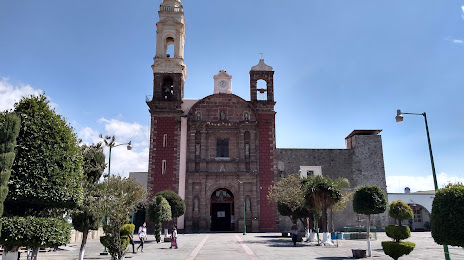
Where is located Zacatelco
Exact location — Zacatelco, Zacatelco, Tlaxcala, Mexico, marked on the map with a red marker.
Coordinates
Zacatelco, Mexico coordinates in decimal format: latitude — 19.1984792, longitude — -98.2486449. When converted to degrees, minutes, seconds Zacatelco has the following coordinates: 19°11′54.53 north latitude and -98°14′55.12 east longitude.
Population
Zacatelco, Zacatelco, Tlaxcala, Mexico, according to our data the population is — 38,466 residents, which is about 0% of the total population of the country (Mexico).
Comparison of the population on the graph:
Exact time
Time zone for this location Zacatelco — UTC -6 America/Mexico_City. Exact time — wednesday, 4 april 2024 year, 21 h. 38 minutes.
Sunrise and sunset
Zacatelco, sunrise and sunset data for a date — wednesday 24.04.2024.
| Sunrise | Sunset | Day (duration) |
|---|---|---|
| 06:11 -0 minutes | 18:50 -0 minutes | 12 h. 42 minutes. -0 minutes |
You can control the scale of the map using the auxiliary tools to find out exactly where it is located Zacatelco. When you change the scale of the map, the width of the ruler also changes (in kilometers and miles).
Nearby cities
The largest cities that are located nearby:
- Puebla — 18 km
- Ixtapaluca — 67 km
- Chalco de Díaz Covarrubias — 68 km
- Texcoco — 74 km
- Chimalhuacan — 78 km
- Ciudad Nezahualcóyotl — 80 km
- Cuautla — 85 km
- Ecatepec — 95 km
- Ojo de Agua — 97 km
- Tulancingo — 99 km
- Coacalco — 101 km
- Jiutepec — 104 km
- Tlalnepantla — 105 km
- Buenavista — 106 km
- Cuernavaca — 106 km
- Naucalpan — 107 km
- Pachuca — 113 km
- Ciudad López Mateos — 113 km
- Cuautitlán Izcalli — 116 km
Distance to neighboring capitals:
- Guatemala City
 (Guatemala) — 966 km
 - Belmopan
 (Belize) — 1025 km
 - Tegucigalpa
 (Honduras) — 1306 km
 - Washington
 (United States) — 2994 km
 - Saint John
 (Puerto Rico) — 3380 km
 - Ottawa
 (Canada) — 3579 km
 - Belgrade
 (Serbia) — 10586 km
 - Podgorica
 (Montenegro) — 10649 km
 - Hagåtña
 (Guam) — 12224 km
Attractions
Distance to the capital
Distance to the capital (Mexico City) is about — 96 km.