 Elba
Medley
Bethany
Chilo
Dobbins Air Reserve Base
Bayview
Fontanelle
Arensburg
Lenz
Bouse
Barry
Carmona
DAEC Helipad
Big Lake
Luzon
Tolo
Karns City
Allenton
Lake County
Elba
Medley
Bethany
Chilo
Dobbins Air Reserve Base
Bayview
Fontanelle
Arensburg
Lenz
Bouse
Barry
Carmona
DAEC Helipad
Big Lake
Luzon
Tolo
Karns City
Allenton
Lake County
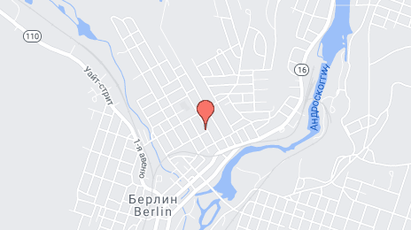
Berlin on the map, United States
Where is located Berlin
Exact location — Berlin, Coos County, New Hampshire, United States, marked on the map with a red marker.
Coordinates
Berlin, United States coordinates in decimal format: latitude — 44.4686696, longitude — -71.1850768. When converted to degrees, minutes, seconds Berlin has the following coordinates: 44°28′7.21 north latitude and -71°11′6.28 east longitude.
Population
Berlin, Coos County, New Hampshire, United States, according to our data the population is — 10,051 residents, which is about 0% of the total population of the country (United States).
Comparison of the population on the graph:
Exact time
Time zone for this location Berlin — UTC -4 America/New_York. Exact time — friday, 4 april 2024 year, 14 h. 47 minutes.
Sunrise and sunset
Berlin, sunrise and sunset data for a date — friday 19.04.2024.
| Sunrise | Sunset | Day (duration) |
|---|---|---|
| 05:56 -1 minute | 19:31 +1 minute | 13 h. 36 minutes. +2 minutes |
You can control the scale of the map using the auxiliary tools to find out exactly where it is located Berlin. When you change the scale of the map, the width of the ruler also changes (in kilometers and miles).
Nearby cities
The largest cities that are located nearby:
- Sherbrooke
 (Canada) — 116 km
 - Manchester — 164 km
- Lowell — 203 km
- Longueuil (Canada) — 215 km
- Montreal (Canada) — 217 km
- Cambridge — 232 km
- Trois-Rivières (Canada) — 232 km
- Laval (Canada) — 232 km
- Boston — 233 km
- Worcester — 249 km
- Levis (Canada) — 251 km
- Quebec (Canada) — 258 km
- Amherst — 259 km
- Springfield — 286 km
- Providence — 293 km
- Hartford — 324 km
- Waterbury — 357 km
- Ottawa (Canada) — 366 km
- Gatineau (Canada) — 367 km
Distance to neighboring capitals:
- Ottawa (Canada) — 371 km
- Nuuk
 (Greenland) — 2506 km
 - Belmopan
 (Belize) — 3445 km
 - Guatemala City
 (Guatemala) — 3790 km
 - Mexico City
 (Mexico) — 3799 km
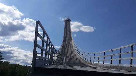
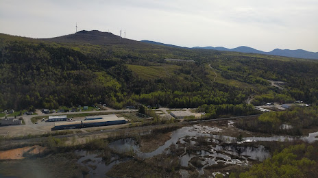
Attractions

Distance to the capital
Distance to the capital (Washington) is about — 786 km.