 Santa Catarina
Lerdo
Campos
Puente de Ixtla
Teziutlán
Merida
Naranjos
Salvatierra
Tultitlán de Mariano Escobedo
Guadalupe
Tuxpan
Topolobampo
Tampico
Jiutepec
Mexicali
Culiacán Rosales
Mazatlán
Celaya
La Paz
Santa Catarina
Lerdo
Campos
Puente de Ixtla
Teziutlán
Merida
Naranjos
Salvatierra
Tultitlán de Mariano Escobedo
Guadalupe
Tuxpan
Topolobampo
Tampico
Jiutepec
Mexicali
Culiacán Rosales
Mazatlán
Celaya
La Paz
Atotonilco El Alto on the map, Mexico
Where is located Atotonilco El Alto
Exact location — Atotonilco El Alto, Atotonilco el Alto, Jalisco, Mexico, marked on the map with a red marker.
Coordinates
Atotonilco El Alto, Mexico coordinates in decimal format: latitude — 20.5502447, longitude — -102.5081224. When converted to degrees, minutes, seconds Atotonilco El Alto has the following coordinates: 20°33′0.88 north latitude and -102°30′29.24 east longitude.
Population
Atotonilco El Alto, Atotonilco el Alto, Jalisco, Mexico, according to our data the population is — 27,012 residents, which is about 0% of the total population of the country (Mexico).
Comparison of the population on the graph:
Exact time
Time zone for this location Atotonilco El Alto — UTC -6 America/Mexico_City. Exact time — friday, 4 april 2024 year, 20 h. 54 minutes.
Sunrise and sunset
Atotonilco El Alto, sunrise and sunset data for a date — friday 19.04.2024.
| Sunrise | Sunset | Day (duration) |
|---|---|---|
| 06:30 -1 minute | 19:07 -0 minutes | 12 h. 36 minutes. +1 minute |
You can control the scale of the map using the auxiliary tools to find out exactly where it is located Atotonilco El Alto. When you change the scale of the map, the width of the ruler also changes (in kilometers and miles).
Nearby cities
The largest cities that are located nearby:
- Zamora — 66 km
- Tonalá — 76 km
- Tlaquepaque — 84 km
- Guadalajara — 88 km
- Zapopan — 95 km
- León — 106 km
- Irapuato — 120 km
- Salamanca — 135 km
- Uruapan — 135 km
- Aguascalientes — 149 km
- Morelia — 165 km
- Celaya — 176 km
- Colima — 192 km
- Santiago de Querétaro — 219 km
- San Luis Potosi — 236 km
- Soledad de Graciano Sánchez — 242 km
- Zacatecas — 246 km
- Manzanillo — 249 km
- San Juan del Río — 262 km
Distance to neighboring capitals:
- Guatemala City
 (Guatemala) — 1430 km
 - Belmopan
 (Belize) — 1491 km
 - Tegucigalpa
 (Honduras) — 1774 km
 - Washington
 (United States) — 3177 km
 - Ottawa
 (Canada) — 3695 km
 - Saint John
 (Puerto Rico) — 3816 km
 - Belgrade
 (Serbia) — 10740 km
 - Podgorica
 (Montenegro) — 10822 km
 - Hagåtña
 (Guam) — 11754 km
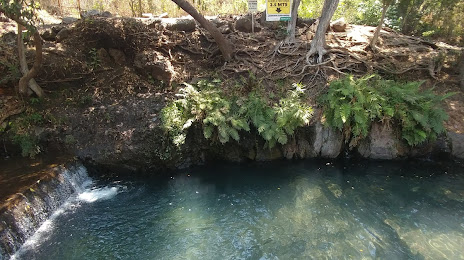
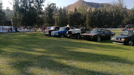
Attractions
Distance to the capital
Distance to the capital (Mexico City) is about — 374 km.