Aguaí
Andradina
Osasco
Jaguariúna
Tanabi
Anastácio
Diadema
São Vicente
Indaiatuba
Passa Quatro
Imperatriz
São José dos Pinhais
Parnaíba
Mandaguari
Rondon
Indaial
Timbó
Matelândia
Medianeira
Aguaí
Andradina
Osasco
Jaguariúna
Tanabi
Anastácio
Diadema
São Vicente
Indaiatuba
Passa Quatro
Imperatriz
São José dos Pinhais
Parnaíba
Mandaguari
Rondon
Indaial
Timbó
Matelândia
Medianeira
Sapiranga on the map, Brazil
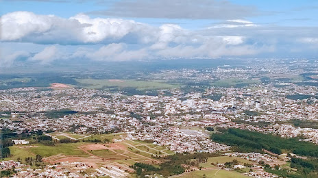
Where is located Sapiranga
Exact location — Sapiranga, Sapiranga, Rio Grande do Sul, Brazil, marked on the map with a red marker.
Coordinates
Sapiranga, Brazil coordinates in decimal format: latitude — -29.6353852, longitude — -51.0069543. When converted to degrees, minutes, seconds Sapiranga has the following coordinates: -29°38′7.39 north latitude and -51°0′25.04 east longitude.
Population
Sapiranga, Sapiranga, Rio Grande do Sul, Brazil, according to our data the population is — 76,053 residents, which is about 0% of the total population of the country (Brazil).
Comparison of the population on the graph:
Exact time
Time zone for this location Sapiranga — UTC -3 America/Sao_Paulo. Exact time — friday, 4 april 2024 year, 17 h. 18 minutes.
Sunrise and sunset
Sapiranga, sunrise and sunset data for a date — friday 19.04.2024.
| Sunrise | Sunset | Day (duration) |
|---|---|---|
| 06:48 +1 minute | 17:57 -1 minute | 11 h. 12 minutes. -2 minutes |
You can control the scale of the map using the auxiliary tools to find out exactly where it is located Sapiranga. When you change the scale of the map, the width of the ruler also changes (in kilometers and miles).
Nearby cities
The largest cities that are located nearby:
- Novo Hamburgo — 13 km
- São Leopoldo — 19 km
- Gravataí — 34 km
- Canoas — 35 km
- Cachoeirinha — 36 km
- Porto Alegre — 49 km
- Viamão — 49 km
- Caxias do Sul — 55 km
- Guaíba — 61 km
- Santa Cruz do Sul — 137 km
- Criciúma — 191 km
- Passo Fundo — 205 km
- Lages — 212 km
- Pelotas — 267 km
- Santa Maria — 270 km
- Rio Grande — 285 km
- Palhoça — 317 km
- Chapecó — 322 km
- São José — 322 km
Distance to neighboring capitals:
- Montevideo
 (Uruguay) — 760 km
 - Asuncion
 (Paraguay) — 810 km
 - Asuncion (Paraguay) — 814 km
- Buenos Aires
 (Argentina) — 887 km
 - Santiago
 (Chile) — 1906 km
 - Nuestra Señora de La Paz
 (Bolivia) — 2278 km
 - Paramaribo
 (Suriname) — 3973 km
 - Georgetown
 (Guyana) — 4124 km
 - Quito
 (Ecuador) — 4382 km
 - Bogota
 (Colombia) — 4533 km
 - Caracas
 (Venezuela) — 4781 km