
 Mairena del Alcor
Aras de los Olmos
El Viso del Alcor
Valdeprado del Río
Solares
Lloseta
Riego
Xilxes
Antequera
Cabra
Vara de Rey
Llano de Olmedo
Lloret de Mar
Herreros de Suso
Montmeló
Polinyà
Alhama de Aragón
Sotelo
Totana
Mairena del Alcor
Aras de los Olmos
El Viso del Alcor
Valdeprado del Río
Solares
Lloseta
Riego
Xilxes
Antequera
Cabra
Vara de Rey
Llano de Olmedo
Lloret de Mar
Herreros de Suso
Montmeló
Polinyà
Alhama de Aragón
Sotelo
Totana
Jódar on the map, Spain
Where is located Jódar
Exact location — Jódar, Jaén, Andalucía, Spain, marked on the map with a red marker.
Coordinates
Jódar, Spain coordinates in decimal format: latitude — 37.8381872, longitude — -3.3514863. When converted to degrees, minutes, seconds Jódar has the following coordinates: 37°50′17.47 north latitude and -3°21′5.35 east longitude.
Population
Jódar, Jaén, Andalucía, Spain, according to our data the population is — 12,031 residents, which is about 0% of the total population of the country (Spain).
Comparison of the population on the graph:
Exact time
Time zone for this location Jódar — UTC +2 Europe/Madrid. Exact time — friday, 4 april 2024 year, 17 h. 11 minutes.
Sunrise and sunset
Jódar, sunrise and sunset data for a date — friday 19.04.2024.
| Sunrise | Sunset | Day (duration) |
|---|---|---|
| 07:34 -2 minutes | 20:50 +1 minute | 13 h. 18 minutes. +3 minutes |
You can control the scale of the map using the auxiliary tools to find out exactly where it is located Jódar. When you change the scale of the map, the width of the ruler also changes (in kilometers and miles).
Nearby cities
The largest cities that are located nearby:
- Jaén — 38 km
- Granada — 76 km
- Córdoba — 125 km
- Almería — 136 km
- Málaga — 156 km
- Albacete — 181 km
- Murcia — 194 km
- Marbella — 200 km
- Cartagena — 208 km
- Dos Hermanas — 234 km
- Algeciras — 266 km
- Fuenlabrada — 274 km
- Getafe — 275 km
- Jerez — 277 km
- Leganés — 278 km
- Móstoles — 278 km
- Alcorcón — 280 km
- Torrejón de Ardoz — 290 km
- Alcala de Henares — 292 km
Distance to neighboring capitals:
- Lisbon
 (Portugal) — 515 km
 - Rabat
 (Morocco) — 533 km
 - Andorra la Vella
 (Andorra) — 664 km
 - Paris
 (France) — 1309 km
 - Paris (France) — 1309 km
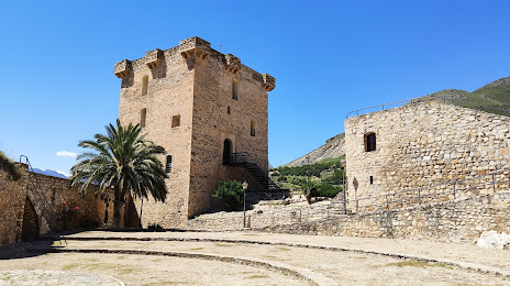
Attractions
Distance to the capital
Distance to the capital (Madrid) is about — 288 km.