
 La Costa
Alcantarilla
Cienaga
Florencia
Riosucio
Canalete
Bello
Cartago
Cota
Duitama
Ibagué
Pasto
Envigado
Popayán
Villavicencio
Manizales
Girardot
Buga
Yumbo
La Costa
Alcantarilla
Cienaga
Florencia
Riosucio
Canalete
Bello
Cartago
Cota
Duitama
Ibagué
Pasto
Envigado
Popayán
Villavicencio
Manizales
Girardot
Buga
Yumbo
Pamplona on the map, Colombia
Where is located Pamplona
Exact location — Pamplona, Pamplona, Norte de Santander, Colombia, marked on the map with a red marker.
Coordinates
Pamplona, Colombia coordinates in decimal format: latitude — 7.37648, longitude — -72.64836. When converted to degrees, minutes, seconds Pamplona has the following coordinates: 7°22′35.33 north latitude and -72°38′54.1 east longitude.
Population
Pamplona, Pamplona, Norte de Santander, Colombia, according to our data the population is — 53,588 residents, which is about 0.1% of the total population of the country (Colombia).
Comparison of the population on the graph:
Exact time
Time zone for this location Pamplona — UTC -5 America/Bogota. Exact time — wednesday, 4 april 2024 year, 15 h. 58 minutes.
Sunrise and sunset
Pamplona, sunrise and sunset data for a date — wednesday 24.04.2024.
| Sunrise | Sunset | Day (duration) |
|---|---|---|
| 05:40 -0 minutes | 17:56 -0 minutes | 12 h. 18 minutes. -0 minutes |
You can control the scale of the map using the auxiliary tools to find out exactly where it is located Pamplona. When you change the scale of the map, the width of the ruler also changes (in kilometers and miles).
Nearby cities
The largest cities that are located nearby:
- Cúcuta — 58 km
- Bucaramanga — 59 km
- Floridablanca — 60 km
- San Cristobal
 (Venezuela) — 64 km
 - Giron — 67 km
- Barrancabermeja — 137 km
- Sogamoso — 186 km
- Ejido (Venezuela) — 201 km
- Merida (Venezuela) — 212 km
- Tunja — 217 km
- Barinas (Venezuela) — 297 km
- Magangué — 309 km
- Bello — 340 km
- Medellín — 344 km
- Valledupar — 349 km
- Envigado — 350 km
- Itagüi — 352 km
- Soacha — 354 km
- Cabimas (Venezuela) — 357 km
Distance to neighboring capitals:
- Caracas (Venezuela) — 718 km
- Panama
 (Panama) — 777 km
 - Quito
 (Ecuador) — 1060 km
 - San Jose
 (Costa Rica) — 1290 km
 - Georgetown
 (Guyana) — 1600 km
 - Nuestra Señora de La Paz
 (Bolivia) — 2701 km
 - Asuncion
 (Paraguay) — 3980 km
 - Santiago
 (Chile) — 4545 km
 - Buenos Aires
 (Argentina) — 4904 km
 - Montevideo
 (Uruguay) — 5011 km
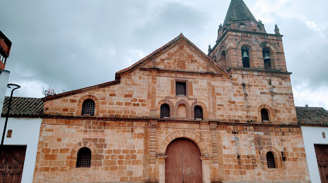
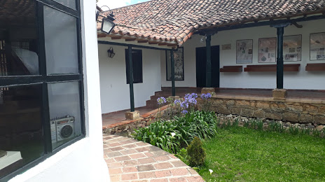
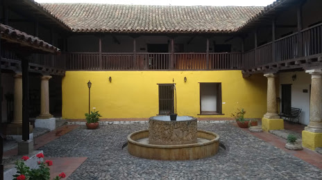
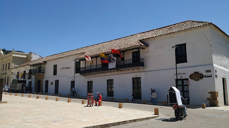
Attractions

Distance to the capital
Distance to the capital (Bogota) is about — 347 km.