
 Bel-Ha
San Jose El Alto
El Porvenir
Nueva Palestina
Santa Lucía
Chemax
La Morita
Temoac
Zacualpan
Bel-Ha
San Jose El Alto
El Porvenir
Nueva Palestina
Santa Lucía
Chemax
La Morita
Temoac
Zacualpan
Área De Protección La Vega Escondida on the map, Ciudad Madero, Mexico
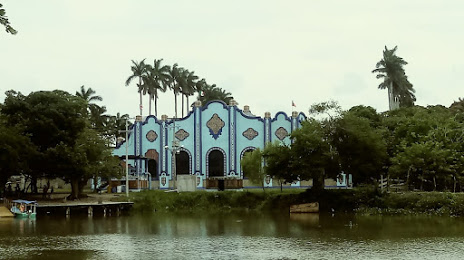
Photo
Where is located Área De Protección La Vega Escondida
Área De Protección La Vega Escondida — local attraction, which is located at Colon 102, Palacio Municipal, tercer piso, Centro, 89000 Tampico, Tamps., Mexico and belongs to the category — wildlife refuge. Average visitor rating for this place — 4.4 (according to 118 ratings, information from open sources and relevant for 2022).
Exact location — Área De Protección La Vega Escondida, marked on the map with a red marker.
You can get directions to Área De Protección La Vega Escondida on the map from your location.
What else is interesting in Ciudad Madero? You can see all the sights if you go to the city page.
Coordinates
Área De Protección La Vega Escondida, Mexico coordinates in decimal format: latitude — 22.29493969786455, longitude — -97.9267838928112. When converted to degrees, minutes, seconds Área De Protección La Vega Escondida has the following coordinates: 22°17′41.78 north latitude and -97°55′36.42 east longitude.
Nearby cities
The largest cities that are located nearby:
- Tampico — 2 km
- Tantoyuca — 107 km
- Poza Rica de Hidalgo — 194 km
- Ciudad Victoria — 210 km
- Tulancingo — 245 km
- Martínez de la Torre — 255 km
- Pachuca — 255 km
- San Juan del Río — 302 km
- Ojo de Agua — 310 km
- Xalapa — 314 km
- Soledad de Graciano Sánchez — 317 km
- Coacalco — 318 km
- Ecatepec — 318 km
- Santiago de Querétaro — 321 km
- San Luis Potosi — 321 km
- Texcoco — 322 km
- Cuautitlán Izcalli — 322 km
- Buenavista — 323 km
- Tlalnepantla — 331 km
Distance to the capital
Distance to the capital (Mexico City) is about — 342 km.