
 Bel-Ha
San Jose El Alto
El Porvenir
Nueva Palestina
Santa Lucía
Chemax
La Morita
Temoac
Zacualpan
Bel-Ha
San Jose El Alto
El Porvenir
Nueva Palestina
Santa Lucía
Chemax
La Morita
Temoac
Zacualpan
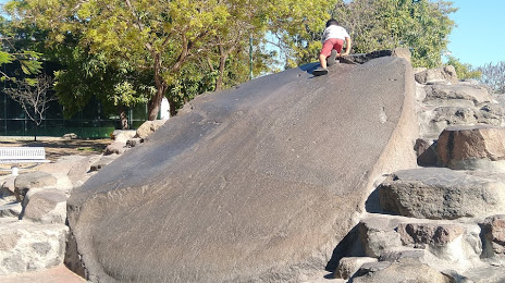
La piedra lisa on the map, Colima, Mexico
Photo
Where is located La piedra lisa
La piedra lisa — local attraction, which is located at Piedra Lisa, 28040 Colima, Mexico and belongs to the category — theme park. Average visitor rating for this place — 4.5 (according to 1326 ratings, information from open sources and relevant for 2022).
Exact location — La piedra lisa, marked on the map with a red marker.
You can get directions to La piedra lisa on the map from your location.
What else is interesting in Colima? You can see all the sights if you go to the city page.
Coordinates
La piedra lisa, Mexico coordinates in decimal format: latitude — 19.239401379597798, longitude — -103.71461749286209. When converted to degrees, minutes, seconds La piedra lisa has the following coordinates: 19°14′21.84 north latitude and -103°42′52.62 east longitude.
Nearby cities
The largest cities that are located nearby:
- Manzanillo — 66 km
- Tlaquepaque — 160 km
- Tonalá — 160 km
- Zapopan — 161 km
- Guadalajara — 161 km
- Zamora — 171 km
- Uruapan — 176 km
- Puerto Vallarta — 220 km
- Morelia — 268 km
- Tepic — 277 km
- Irapuato — 292 km
- León — 296 km
- Salamanca — 299 km
- Aguascalientes — 327 km
- Celaya — 333 km
- Santiago de Querétaro — 376 km
- Zacatecas — 407 km
- San Juan del Río — 408 km
- Toluca — 425 km
Distance to the capital
Distance to the capital (Mexico City) is about — 481 km.