 Teapa
Berriozábal
Nicolás Ruíz
Ciudad López Mateos
Malinalco
Mexico City
Huitzuco
Tierra Colorada
Amacuzac
Calpulalpan
Ixmiquilpan
Tepeapulco
Apan
Chiautempan
Zacatlán
Taxco
Yanga
Matías Romero
San Martín Coapaxtongo
Teapa
Berriozábal
Nicolás Ruíz
Ciudad López Mateos
Malinalco
Mexico City
Huitzuco
Tierra Colorada
Amacuzac
Calpulalpan
Ixmiquilpan
Tepeapulco
Apan
Chiautempan
Zacatlán
Taxco
Yanga
Matías Romero
San Martín Coapaxtongo
Comalcalco on the map, Mexico
Where is located Comalcalco
Exact location — Comalcalco, Comalcalco Municipality, Tabasco, Mexico, marked on the map with a red marker.
Coordinates
Comalcalco, Mexico coordinates in decimal format: latitude — 18.261156, longitude — -93.2216864. When converted to degrees, minutes, seconds Comalcalco has the following coordinates: 18°15′40.16 north latitude and -93°13′18.07 east longitude.
Population
Comalcalco, Comalcalco Municipality, Tabasco, Mexico, according to our data the population is — 40,992 residents, which is about 0% of the total population of the country (Mexico).
Comparison of the population on the graph:
Exact time
Time zone for this location Comalcalco — UTC -6 America/Mexico_City. Exact time — thursday, 4 april 2024 year, 13 h. 31 minute.
Sunrise and sunset
Comalcalco, sunrise and sunset data for a date — thursday 25.04.2024.
| Sunrise | Sunset | Day (duration) |
|---|---|---|
| 05:51 -0 minutes | 18:30 +1 minute | 12 h. 42 minutes. +1 minute |
You can control the scale of the map using the auxiliary tools to find out exactly where it is located Comalcalco. When you change the scale of the map, the width of the ruler also changes (in kilometers and miles).
Nearby cities
The largest cities that are located nearby:
- Villahermosa — 42 km
- Coatzacoalcos — 131 km
- Minatitlán — 143 km
- Ciudad del Carmen — 154 km
- Tuxtla Gutiérrez — 167 km
- San Cristóbal de las Casas — 180 km
- Campeche — 329 km
- Tapachula — 385 km
- Oaxaca — 393 km
- Córdoba — 393 km
- Xalapa — 410 km
- Orizaba — 411 km
- Quetzaltenango
 (Guatemala) — 421 km
 - Tehuacán — 439 km
- Martínez de la Torre — 445 km
- San Juan Sacatepéquez (Guatemala) — 479 km
- Merida — 479 km
- Guatemala City (Guatemala) — 495 km
- Villa Nueva (Guatemala) — 500 km
Distance to neighboring capitals:
- Belmopan
 (Belize) — 485 km
 - Guatemala City (Guatemala) — 497 km
- Tegucigalpa
 (Honduras) — 792 km
 - Washington
 (United States) — 2778 km
 - Saint John
 (Puerto Rico) — 2860 km
 - Ottawa
 (Canada) — 3428 km
 - Belgrade
 (Serbia) — 10328 km
 - Podgorica
 (Montenegro) — 10371 km
 - Hagåtña
 (Guam) — 12750 km
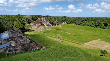
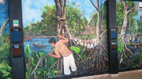
Attractions
Distance to the capital
Distance to the capital (Mexico City) is about — 636 km.