 Tulum
El Crucero
Kantunilkín
Maxcanú
Halachó
Champoton
Cacalchén
San Buenaventura
San Juan
Santiago Tianguistenco
Zaragoza
Jesús del Monte
Tlaltizapán
Atlatlahucan
Amecameca
Tlapa de Comonfort
Tepoztlán
Tetecala
Amacuzac
Tulum
El Crucero
Kantunilkín
Maxcanú
Halachó
Champoton
Cacalchén
San Buenaventura
San Juan
Santiago Tianguistenco
Zaragoza
Jesús del Monte
Tlaltizapán
Atlatlahucan
Amecameca
Tlapa de Comonfort
Tepoztlán
Tetecala
Amacuzac
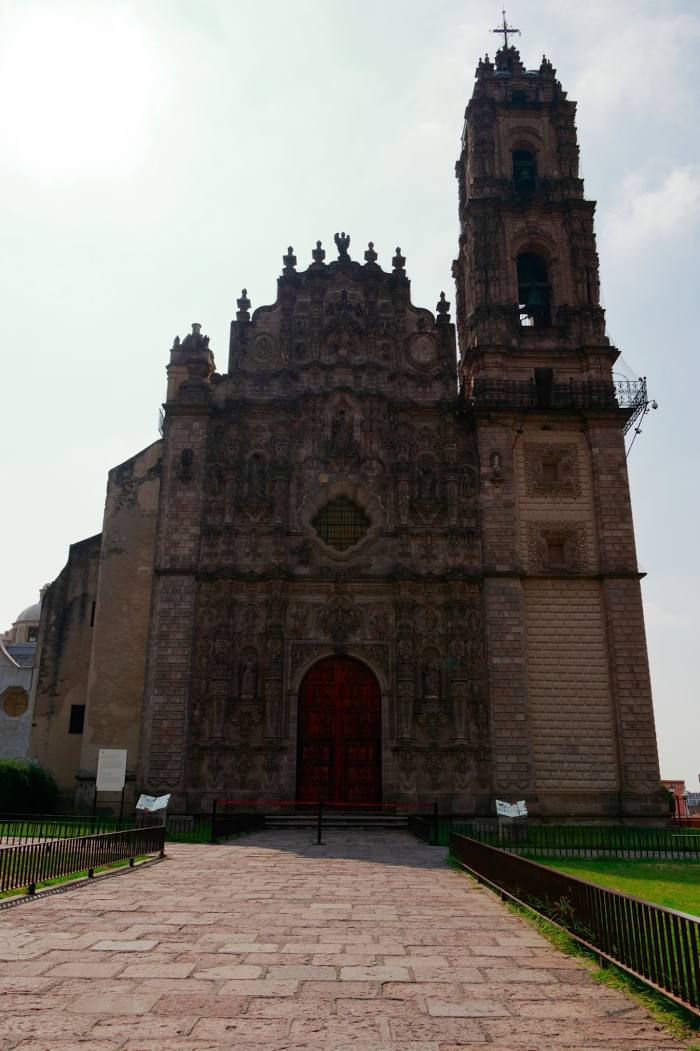
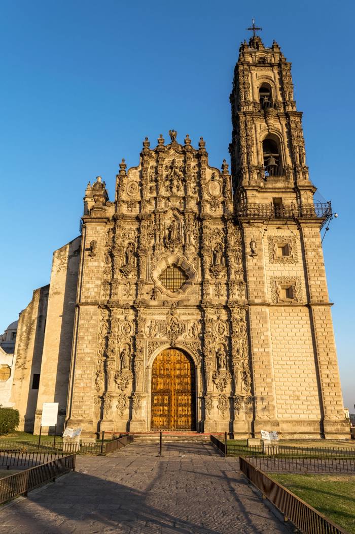
Tepotzotlán on the map, Mexico
Where is located Tepotzotlán
Exact location — Tepotzotlán, Tepotzotlán, Estado de México, Mexico, marked on the map with a red marker.
Coordinates
Tepotzotlán, Mexico coordinates in decimal format: latitude — 19.7185096, longitude — -99.2065202. When converted to degrees, minutes, seconds Tepotzotlán has the following coordinates: 19°43′6.63 north latitude and -99°12′23.47 east longitude.
Population
Tepotzotlán, Tepotzotlán, Estado de México, Mexico, according to our data the population is — 44,519 residents, which is about 0% of the total population of the country (Mexico).
Comparison of the population on the graph:
Exact time
Time zone for this location Tepotzotlán — UTC -6 America/Mexico_City. Exact time — friday, 4 april 2024 year, 21 h. 36 minutes.
Sunrise and sunset
Tepotzotlán, sunrise and sunset data for a date — friday 19.04.2024.
| Sunrise | Sunset | Day (duration) |
|---|---|---|
| 06:17 -1 minute | 18:53 -0 minutes | 12 h. 36 minutes. +1 minute |
You can control the scale of the map using the auxiliary tools to find out exactly where it is located Tepotzotlán. When you change the scale of the map, the width of the ruler also changes (in kilometers and miles).
Nearby cities
The largest cities that are located nearby:
- Cuautitlán Izcalli — 9 km
- Buenavista — 13 km
- Coacalco — 15 km
- Ojo de Agua — 19 km
- Ciudad López Mateos — 19 km
- Tlalnepantla — 20 km
- Ecatepec — 21 km
- Naucalpan — 26 km
- Texcoco — 41 km
- Chimalhuacan — 41 km
- Ciudad Nezahualcóyotl — 42 km
- Ixtapaluca — 57 km
- Chalco de Díaz Covarrubias — 60 km
- Pachuca — 63 km
- Metepec — 66 km
- Toluca — 67 km
- Cuernavaca — 88 km
- Jiutepec — 92 km
- Tulancingo — 96 km
Distance to neighboring capitals:
- Guatemala City
 (Guatemala) — 1082 km
 - Belmopan
 (Belize) — 1135 km
 - Tegucigalpa
 (Honduras) — 1421 km
 - Washington
 (United States) — 3013 km
 - Saint John
 (Puerto Rico) — 3477 km
 - Ottawa
 (Canada) — 3581 km
 - Belgrade
 (Serbia) — 10603 km
 - Podgorica
 (Montenegro) — 10671 km
 - Hagåtña
 (Guam) — 12109 km
Attractions

Distance to the capital
Distance to the capital (Mexico City) is about — 33 km.