 Saucillo
Jiménez
Parras
Santiago Papasquiaro
Pánuco
Muzquiz
El Coyote
Nazareno
El Madroño
San Marcos
Atoyac
Cruz Grande
Cuautepec
Petatlán
Montecillo
Tepotzotlán
Tultepec
San José el Vidrio
Tizayuca
Saucillo
Jiménez
Parras
Santiago Papasquiaro
Pánuco
Muzquiz
El Coyote
Nazareno
El Madroño
San Marcos
Atoyac
Cruz Grande
Cuautepec
Petatlán
Montecillo
Tepotzotlán
Tultepec
San José el Vidrio
Tizayuca
Champoton on the map, Mexico
Where is located Champoton
Exact location — Champoton, Champoton, Campeche, Mexico, marked on the map with a red marker.
Coordinates
Champoton, Mexico coordinates in decimal format: latitude — 19.3471645, longitude — -90.7200237. When converted to degrees, minutes, seconds Champoton has the following coordinates: 19°20′49.79 north latitude and -90°43′12.09 east longitude.
Population
Champoton, Champoton, Campeche, Mexico, according to our data the population is — 24,809 residents, which is about 0% of the total population of the country (Mexico).
Comparison of the population on the graph:
Exact time
Time zone for this location Champoton — UTC -6 America/Mexico_City. Exact time — saturday, 4 april 2024 year, 07 h. 01 minute.
Sunrise and sunset
Champoton, sunrise and sunset data for a date — saturday 20.04.2024.
| Sunrise | Sunset | Day (duration) |
|---|---|---|
| 05:43 -1 minute | 18:19 -0 minutes | 12 h. 36 minutes. +1 minute |
You can control the scale of the map using the auxiliary tools to find out exactly where it is located Champoton. When you change the scale of the map, the width of the ruler also changes (in kilometers and miles).
Nearby cities
The largest cities that are located nearby:
- Campeche — 57 km
- Ciudad del Carmen — 138 km
- Merida — 214 km
- Chetumal — 271 km
- Villahermosa — 278 km
- San Cristóbal de las Casas — 353 km
- Tuxtla Gutiérrez — 382 km
- Coatzacoalcos — 415 km
- Minatitlán — 430 km
- Cancún — 446 km
- Quetzaltenango
 (Guatemala) — 506 km
 - Choloma
 (Honduras) — 509 km
 - San Juan Sacatepéquez (Guatemala) — 512 km
- San Pedro Sula (Honduras) — 513 km
- Tapachula — 518 km
- Guatemala City (Guatemala) — 524 km
- Villa Nueva (Guatemala) — 533 km
- El Progreso (Honduras) — 536 km
- Villa Canales (Guatemala) — 539 km
Distance to neighboring capitals:
- Belmopan
 (Belize) — 311 km
 - Guatemala City (Guatemala) — 527 km
- Tegucigalpa (Honduras) — 694 km
- Washington
 (United States) — 2543 km
 - Saint John
 (Puerto Rico) — 2590 km
 - Ottawa
 (Canada) — 3213 km
 - Belgrade
 (Serbia) — 10064 km
 - Podgorica
 (Montenegro) — 10102 km
 - Hagåtña
 (Guam) — 12935 km
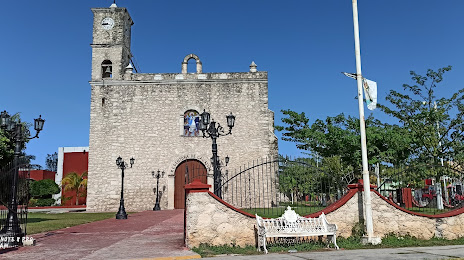
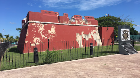
Attractions
Distance to the capital
Distance to the capital (Mexico City) is about — 883 km.