
 Bel-Ha
San Jose El Alto
El Porvenir
Nueva Palestina
Santa Lucía
Chemax
La Morita
Temoac
Zacualpan
Bel-Ha
San Jose El Alto
El Porvenir
Nueva Palestina
Santa Lucía
Chemax
La Morita
Temoac
Zacualpan
Centro Cultural El Refugio on the map, Tlaquepaque, Mexico
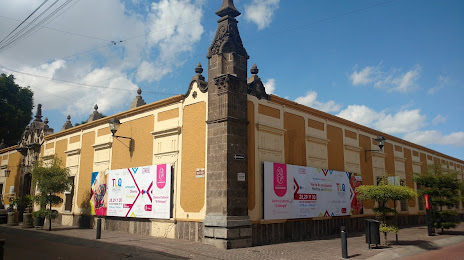
Photo
Where is located Centro Cultural El Refugio
Centro Cultural El Refugio — local attraction, which is located at C. Donato Guerra 160, San Juan, 45500 San Pedro Tlaquepaque, Jal., Mexico and belongs to the category — cultural center. Average visitor rating for this place — 4.7 (according to 4562 ratings, information from open sources and relevant for 2022).
Exact location — Centro Cultural El Refugio, marked on the map with a red marker.
You can get directions to Centro Cultural El Refugio on the map from your location.
What else is interesting in Tlaquepaque? You can see all the sights if you go to the city page.
Coordinates
Centro Cultural El Refugio, Mexico coordinates in decimal format: latitude — 20.64140330108472, longitude — -103.31402207269069. When converted to degrees, minutes, seconds Centro Cultural El Refugio has the following coordinates: 20°38′29.05 north latitude and -103°18′50.48 east longitude.
Nearby cities
The largest cities that are located nearby:
- Guadalajara — 4 km
- Tonalá — 8 km
- Zapopan — 11 km
- Zamora — 129 km
- Colima — 160 km
- Aguascalientes — 173 km
- León — 176 km
- Tepic — 189 km
- Uruapan — 190 km
- Puerto Vallarta — 198 km
- Manzanillo — 200 km
- Irapuato — 203 km
- Salamanca — 219 km
- Morelia — 243 km
- Zacatecas — 247 km
- Celaya — 259 km
- Fresnillo — 284 km
- San Luis Potosi — 291 km
- Soledad de Graciano Sánchez — 297 km
Distance to the capital
Distance to the capital (Mexico City) is about — 457 km.