
 Bel-Ha
San Jose El Alto
El Porvenir
Nueva Palestina
Santa Lucía
Chemax
La Morita
Temoac
Zacualpan
Bel-Ha
San Jose El Alto
El Porvenir
Nueva Palestina
Santa Lucía
Chemax
La Morita
Temoac
Zacualpan
Paseo Canal de la Perla on the map, Torreón, Mexico
Photo
Where is located Paseo Canal de la Perla
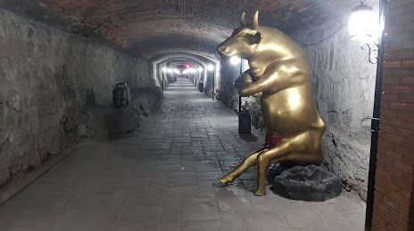
Paseo Canal de la Perla — local attraction, which is located at Av. Juarez 1206, Primitivo Centro, Torreón, Coah., Mexico and belongs to the category — park. Average visitor rating for this place — 4.1 (according to 61 rating, information from open sources and relevant for 2022).
Exact location — Paseo Canal de la Perla, marked on the map with a red marker.
You can get directions to Paseo Canal de la Perla on the map from your location.
What else is interesting in Torreón? You can see all the sights if you go to the city page.
Coordinates
Paseo Canal de la Perla, Mexico coordinates in decimal format: latitude — 25.53761638161873, longitude — -103.46351877260045. When converted to degrees, minutes, seconds Paseo Canal de la Perla has the following coordinates: 25°32′15.42 north latitude and -103°27′48.67 east longitude.
Nearby cities
The largest cities that are located nearby:
- Gómez Palacio — 9 km
- Matamoros — 18 km
- Durango — 210 km
- Saltillo — 241 km
- Monclova — 247 km
- Fresnillo — 267 km
- Santa Catarina — 294 km
- San Pedro Garza García — 300 km
- Monterrey — 308 km
- General Escobedo — 309 km
- San Nicolas de los Garza — 312 km
- Guadalupe — 314 km
- Zacatecas — 318 km
- Apodaca — 322 km
- Delicias — 355 km
- Mazatlán — 397 km
- Aguascalientes — 420 km
- Chihuahua — 428 km
- Nuevo Laredo — 435 km
Distance to the capital
Distance to the capital (Mexico City) is about — 812 km.