 Bel-Ha
San Jose El Alto
El Porvenir
Nueva Palestina
Santa Lucía
Chemax
La Morita
Temoac
Zacualpan
Bel-Ha
San Jose El Alto
El Porvenir
Nueva Palestina
Santa Lucía
Chemax
La Morita
Temoac
Zacualpan
Museo del Agrarismo Mexicano on the map, Matamoros, Mexico
Photo
Where is located Museo del Agrarismo Mexicano
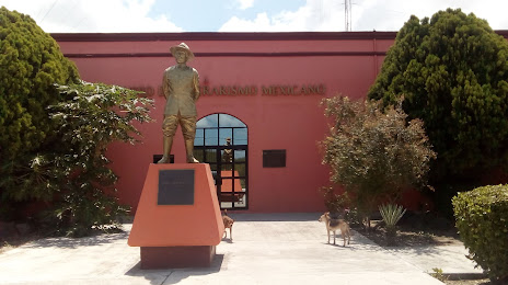
Museo del Agrarismo Mexicano — local attraction, which is located at Lauro Villar Km. 7.5 Ejido Lucio Blanco Matamoros 87300 MX, Lucio Blanco, Heroica Matamoros, Tamps., Mexico and belongs to the category — museum. Average visitor rating for this place — 4.6 (according to 101 rating, information from open sources and relevant for 2022).
Exact location — Museo del Agrarismo Mexicano, marked on the map with a red marker.
You can get directions to Museo del Agrarismo Mexicano on the map from your location.
What else is interesting in Matamoros? You can see all the sights if you go to the city page.
Coordinates
Museo del Agrarismo Mexicano, Mexico coordinates in decimal format: latitude — 25.847194494957964, longitude — -97.45455769274315. When converted to degrees, minutes, seconds Museo del Agrarismo Mexicano has the following coordinates: 25°50′49.9 north latitude and -97°27′16.41 east longitude.
Nearby cities
The largest cities that are located nearby:
- Brownsville
 (United States) — 4 km
 - Reynosa — 81 km
- McAllen (United States) — 81 km
- Corpus Christi (United States) — 214 km
- Laredo (United States) — 267 km
- Apodaca — 267 km
- Nuevo Laredo — 268 km
- Guadalupe — 276 km
- San Nicolas de los Garza — 278 km
- General Escobedo — 280 km
- Monterrey — 281 km
- Ciudad Victoria — 288 km
- San Pedro Garza García — 290 km
- Santa Catarina — 296 km
- Saltillo — 352 km
- Ciudad Madero — 402 km
- Monclova — 403 km
- Tampico — 404 km
- San Antonio (United States) — 404 km
Distance to the capital
Distance to the capital (Mexico City) is about — 734 km.