
 Bel-Ha
San Jose El Alto
El Porvenir
Nueva Palestina
Santa Lucía
Chemax
La Morita
Temoac
Zacualpan
Bel-Ha
San Jose El Alto
El Porvenir
Nueva Palestina
Santa Lucía
Chemax
La Morita
Temoac
Zacualpan
Parque Regional Los Sabinos on the map, Atotonilco El Alto, Mexico
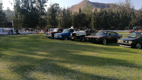
Photo
Where is located Parque Regional Los Sabinos
Parque Regional Los Sabinos — local attraction, which is located at Atotonilco El Alto, Jalisco, Mexico and belongs to the category — park. Average visitor rating for this place — 4.6 (according to 326 ratings, information from open sources and relevant for 2022).
Exact location — Parque Regional Los Sabinos, marked on the map with a red marker.
You can get directions to Parque Regional Los Sabinos on the map from your location.
What else is interesting in Atotonilco El Alto? You can see all the sights if you go to the city page.
Coordinates
Parque Regional Los Sabinos, Mexico coordinates in decimal format: latitude — 20.563675269726275, longitude — -102.47873969284097. When converted to degrees, minutes, seconds Parque Regional Los Sabinos has the following coordinates: 20°33′49.23 north latitude and -102°28′43.46 east longitude.
Nearby cities
The largest cities that are located nearby:
- Zamora — 66 km
- Tonalá — 76 km
- Tlaquepaque — 84 km
- Guadalajara — 88 km
- Zapopan — 95 km
- León — 106 km
- Irapuato — 120 km
- Salamanca — 135 km
- Uruapan — 135 km
- Aguascalientes — 149 km
- Morelia — 165 km
- Celaya — 176 km
- Colima — 192 km
- Santiago de Querétaro — 219 km
- San Luis Potosi — 236 km
- Soledad de Graciano Sánchez — 242 km
- Zacatecas — 246 km
- Manzanillo — 249 km
- San Juan del Río — 262 km
Distance to the capital
Distance to the capital (Mexico City) is about — 372 km.