 Bel-Ha
San Jose El Alto
El Porvenir
Nueva Palestina
Santa Lucía
Chemax
La Morita
Temoac
Zacualpan
Bel-Ha
San Jose El Alto
El Porvenir
Nueva Palestina
Santa Lucía
Chemax
La Morita
Temoac
Zacualpan
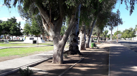
"Los Pioneros" Park (Parque "Los Pioneros") on the map, Ciudad Obregón, Mexico
Photo
Where is located "Los Pioneros" Park (Parque "Los Pioneros")
"Los Pioneros" Park (Parque "Los Pioneros") — local attraction, which is located at C. Yaqui, Norte, 85040 Cd Obregón, Son., Mexico and belongs to the category — park. Average visitor rating for this place — 4.7 (according to 2176 ratings, information from open sources and relevant for 2022).
Exact location — "Los Pioneros" Park (Parque "Los Pioneros"), marked on the map with a red marker.
You can get directions to "Los Pioneros" Park (Parque "Los Pioneros") on the map from your location.
What else is interesting in Ciudad Obregón? You can see all the sights if you go to the city page.
Coordinates
"Los Pioneros" Park (Parque "Los Pioneros"), Mexico coordinates in decimal format: latitude — 27.50243336821482, longitude — -109.93851569270817. When converted to degrees, minutes, seconds "Los Pioneros" Park (Parque "Los Pioneros") has the following coordinates: 27°30′8.76 north latitude and -109°56′18.66 east longitude.
Nearby cities
The largest cities that are located nearby:
- Navojoa — 66 km
- Guaymas — 106 km
- Hermosillo — 202 km
- Los Mochis — 209 km
- La Paz — 371 km
- Chihuahua — 396 km
- Nogales
 (United States) — 437 km
 - Delicias — 441 km
- Tucson (United States) — 532 km
- Ciudad Juarez — 570 km
- El Paso (United States) — 577 km
- Mazatlán — 589 km
- Durango — 656 km
- Chandler (United States) — 668 km
- Gilbert (United States) — 671 km
- Gómez Palacio — 676 km
- Mesa (United States) — 679 km
- Tempe (United States) — 683 km
- Torreón — 685 km
Distance to the capital
Distance to the capital (Mexico City) is about — 1420 km.