
 Bel-Ha
San Jose El Alto
El Porvenir
Nueva Palestina
Santa Lucía
Chemax
La Morita
Temoac
Zacualpan
Bel-Ha
San Jose El Alto
El Porvenir
Nueva Palestina
Santa Lucía
Chemax
La Morita
Temoac
Zacualpan
Jardin Botanico UNACAR on the map, Ciudad del Carmen, Mexico
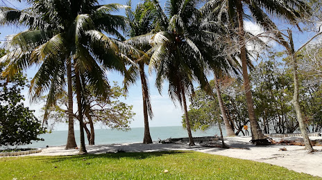
Photo
Where is located Jardin Botanico UNACAR
Jardin Botanico UNACAR — local attraction, which is located at C. Laguna de Términos S/N, Renovacion 2da SEcción, 24155 Cd del Carmen, Camp., Mexico and belongs to the category — botanical garden. Average visitor rating for this place — 4.4 (according to 374 ratings, information from open sources and relevant for 2022).
Exact location — Jardin Botanico UNACAR, marked on the map with a red marker.
You can get directions to Jardin Botanico UNACAR on the map from your location.
What else is interesting in Ciudad del Carmen? You can see all the sights if you go to the city page.
Coordinates
Jardin Botanico UNACAR, Mexico coordinates in decimal format: latitude — 18.63716796503523, longitude — -91.77757439579828. When converted to degrees, minutes, seconds Jardin Botanico UNACAR has the following coordinates: 18°38′13.8 north latitude and -91°46′39.27 east longitude.
Nearby cities
The largest cities that are located nearby:
- Villahermosa — 140 km
- Campeche — 186 km
- San Cristóbal de las Casas — 229 km
- Tuxtla Gutiérrez — 251 km
- Coatzacoalcos — 284 km
- Minatitlán — 298 km
- Merida — 343 km
- Chetumal — 369 km
- Tapachula — 417 km
- Quetzaltenango
 (Guatemala) — 423 km
 - San Juan Sacatepéquez (Guatemala) — 452 km
- Guatemala City (Guatemala) — 467 km
- Villa Nueva (Guatemala) — 474 km
- Villa Canales (Guatemala) — 482 km
- Escuintla (Guatemala) — 493 km
- San Pedro Sula
 (Honduras) — 532 km
 - Choloma (Honduras) — 532 km
- Córdoba — 536 km
- Xalapa — 541 km
Distance to the capital
Distance to the capital (Mexico City) is about — 778 km.