
 Bel-Ha
San Jose El Alto
El Porvenir
Nueva Palestina
Santa Lucía
Chemax
La Morita
Temoac
Zacualpan
Bel-Ha
San Jose El Alto
El Porvenir
Nueva Palestina
Santa Lucía
Chemax
La Morita
Temoac
Zacualpan
Campestre Mante on the map, Ciudad Mante, Mexico
Photo
Where is located Campestre Mante
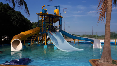
Campestre Mante — local attraction, which is located at Sin Nombre de Colonia 5, 89898 Ciudad Mante, Tamaulipas, Mexico and belongs to the category — water park. Average visitor rating for this place — 4.4 (according to 290 ratings, information from open sources and relevant for 2022).
Exact location — Campestre Mante, marked on the map with a red marker.
You can get directions to Campestre Mante on the map from your location.
What else is interesting in Ciudad Mante? You can see all the sights if you go to the city page.
Coordinates
Campestre Mante, Mexico coordinates in decimal format: latitude — 22.712414800808116, longitude — -98.97884560267141. When converted to degrees, minutes, seconds Campestre Mante has the following coordinates: 22°42′44.69 north latitude and -98°58′43.84 east longitude.
Nearby cities
The largest cities that are located nearby:
- Ciudad Victoria — 111 km
- Tampico — 127 km
- Ciudad Madero — 128 km
- Tantoyuca — 172 km
- Soledad de Graciano Sánchez — 210 km
- San Luis Potosi — 216 km
- Santiago de Querétaro — 280 km
- San Juan del Río — 281 km
- Poza Rica de Hidalgo — 291 km
- Pachuca — 293 km
- Tulancingo — 301 km
- Celaya — 310 km
- León — 332 km
- Salamanca — 333 km
- Irapuato — 336 km
- Ojo de Agua — 339 km
- Cuautitlán Izcalli — 343 km
- Coacalco — 344 km
- Ecatepec — 347 km
Distance to the capital
Distance to the capital (Mexico City) is about — 365 km.