
 Santo Tomás
San Luis De Palenque
Casco Urbano De Tame
Corinto
Flandes
Pesca
El Retiro
Corozal
Albania
Gómez Plata
Carepa
Urrao
Villa Del Rosario
Pradera
El Banco
Victoria
Santander De Quilichao
Fosca
Lorica
Santo Tomás
San Luis De Palenque
Casco Urbano De Tame
Corinto
Flandes
Pesca
El Retiro
Corozal
Albania
Gómez Plata
Carepa
Urrao
Villa Del Rosario
Pradera
El Banco
Victoria
Santander De Quilichao
Fosca
Lorica
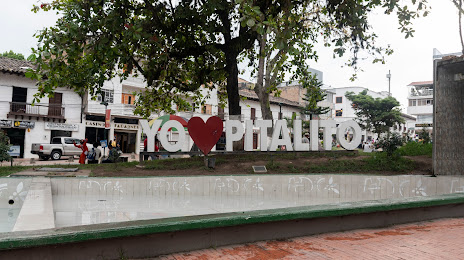
Pitalito on the map, Colombia
Where is located Pitalito
Exact location — Pitalito, Huila, Colombia, marked on the map with a red marker.
Coordinates
Pitalito, Colombia coordinates in decimal format: latitude — 1.856293, longitude — -76.039391. When converted to degrees, minutes, seconds Pitalito has the following coordinates: 1°51′22.65 north latitude and -76°2′21.81 east longitude.
Population
Pitalito, Huila, Colombia, according to our data the population is — 53,686 residents, which is about 0.1% of the total population of the country (Colombia).
Comparison of the population on the graph:
Exact time
Time zone for this location Pitalito — UTC -5 America/Bogota. Exact time — friday, 4 april 2024 year, 13 h. 12 minutes.
Sunrise and sunset
Pitalito, sunrise and sunset data for a date — friday 19.04.2024.
| Sunrise | Sunset | Day (duration) |
|---|---|---|
| 06:00 -0 minutes | 18:05 -0 minutes | 12 h. 6 minutes. -0 minutes |
You can control the scale of the map using the auxiliary tools to find out exactly where it is located Pitalito. When you change the scale of the map, the width of the ruler also changes (in kilometers and miles).
Nearby cities
The largest cities that are located nearby:
- Florencia — 54 km
- Popayán — 90 km
- Neiva — 144 km
- Pasto — 154 km
- Cali — 183 km
- Palmira — 187 km
- Buga — 228 km
- Tuluá — 247 km
- Buenaventura — 251 km
- Ibarra
 (Ecuador) — 284 km
 - Armenia — 299 km
- Ibagué — 299 km
- Girardot — 302 km
- Cartago — 320 km
- Pereira — 329 km
- Dos Quebradas — 332 km
- Quito (Ecuador) — 350 km
- Manizales — 360 km
- Soacha — 362 km
Distance to neighboring capitals:
- Quito (Ecuador) — 353 km
- Panama
 (Panama) — 881 km
 - San Jose
 (Costa Rica) — 1264 km
 - Caracas
 (Venezuela) — 1393 km
 - Georgetown
 (Guyana) — 2056 km
 - Nuestra Señora de La Paz
 (Bolivia) — 2218 km
 - Asuncion
 (Paraguay) — 3613 km
 - Santiago
 (Chile) — 3966 km
 - Buenos Aires
 (Argentina) — 4454 km
 - Montevideo
 (Uruguay) — 4583 km
Attractions
Distance to the capital
Distance to the capital (Bogota) is about — 375 km.