
 Bel-Ha
San Jose El Alto
El Porvenir
Nueva Palestina
Santa Lucía
Chemax
La Morita
Temoac
Zacualpan
Bel-Ha
San Jose El Alto
El Porvenir
Nueva Palestina
Santa Lucía
Chemax
La Morita
Temoac
Zacualpan
Plaza Mayor Torreón on the map, Gómez Palacio, Mexico
Photo
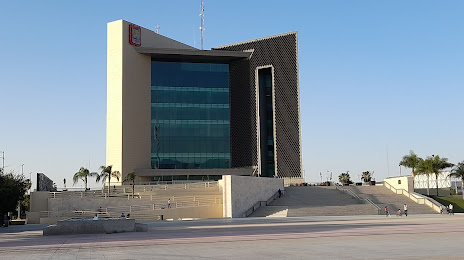
Where is located Plaza Mayor Torreón
Plaza Mayor Torreón — local attraction, which is located at Av Allende 333 Poniente, Primero de Cobián Centro, 27000 Torreón, Coah., Mexico and belongs to the category — plaza. Average visitor rating for this place — 4.5 (according to 11923 ratings, information from open sources and relevant for 2022).
Exact location — Plaza Mayor Torreón, marked on the map with a red marker.
You can get directions to Plaza Mayor Torreón on the map from your location.
What else is interesting in Gómez Palacio? You can see all the sights if you go to the city page.
Coordinates
Plaza Mayor Torreón, Mexico coordinates in decimal format: latitude — 25.540766121942863, longitude — -103.45331197543415. When converted to degrees, minutes, seconds Plaza Mayor Torreón has the following coordinates: 25°32′26.76 north latitude and -103°27′11.92 east longitude.
Nearby cities
The largest cities that are located nearby:
- Torreón — 9 km
- Matamoros — 27 km
- Durango — 209 km
- Saltillo — 249 km
- Monclova — 250 km
- Fresnillo — 274 km
- Santa Catarina — 302 km
- San Pedro Garza García — 307 km
- Monterrey — 316 km
- General Escobedo — 316 km
- San Nicolas de los Garza — 319 km
- Guadalupe — 322 km
- Zacatecas — 325 km
- Apodaca — 329 km
- Delicias — 347 km
- Mazatlán — 394 km
- Chihuahua — 420 km
- Aguascalientes — 427 km
- Nuevo Laredo — 439 km
Distance to the capital
Distance to the capital (Mexico City) is about — 811 km.