
 Bel-Ha
San Jose El Alto
El Porvenir
Nueva Palestina
Santa Lucía
Chemax
La Morita
Temoac
Zacualpan
Bel-Ha
San Jose El Alto
El Porvenir
Nueva Palestina
Santa Lucía
Chemax
La Morita
Temoac
Zacualpan
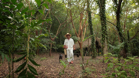
Eco Park Xanath - Papantla on the map, Papantla, Mexico
Photo
Where is located Eco Park Xanath - Papantla
Eco Park Xanath - Papantla — local attraction, which is located at Antigua Camino a Macillas Km 0.700, 93400 Papantla de Olarte, Ver., Mexico and belongs to the category — park. Average visitor rating for this place — 4.7 (according to 112 ratings, information from open sources and relevant for 2022).
Exact location — Eco Park Xanath - Papantla, marked on the map with a red marker.
You can get directions to Eco Park Xanath - Papantla on the map from your location.
What else is interesting in Papantla? You can see all the sights if you go to the city page.
Coordinates
Eco Park Xanath - Papantla, Mexico coordinates in decimal format: latitude — 20.425864642185577, longitude — -97.328547675528. When converted to degrees, minutes, seconds Eco Park Xanath - Papantla has the following coordinates: 20°25′33.11 north latitude and -97°19′42.77 east longitude.
Nearby cities
The largest cities that are located nearby:
- Poza Rica de Hidalgo — 17 km
- Martínez de la Torre — 51 km
- Xalapa — 109 km
- Tulancingo — 117 km
- Tantoyuca — 136 km
- Pachuca — 155 km
- Córdoba — 179 km
- Orizaba — 179 km
- Puebla — 182 km
- Texcoco — 194 km
- Ojo de Agua — 198 km
- Ecatepec — 204 km
- Tampico — 204 km
- Ciudad Madero — 205 km
- Chimalhuacan — 205 km
- Ixtapaluca — 207 km
- Coacalco — 208 km
- Ciudad Nezahualcóyotl — 210 km
- Chalco de Díaz Covarrubias — 211 km
Distance to the capital
Distance to the capital (Mexico City) is about — 219 km.