
 Bel-Ha
San Jose El Alto
El Porvenir
Nueva Palestina
Santa Lucía
Chemax
La Morita
Temoac
Zacualpan
Bel-Ha
San Jose El Alto
El Porvenir
Nueva Palestina
Santa Lucía
Chemax
La Morita
Temoac
Zacualpan
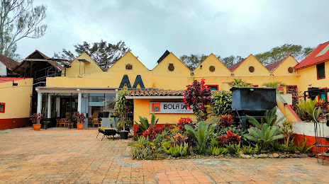
Museo Bola de Oro Finca Roma on the map, Coatepec, Mexico
Photo
Where is located Museo Bola de Oro Finca Roma
Museo Bola de Oro Finca Roma — local attraction, which is located at Calle Principal S/N Localidad Roma Emiliano Zapata, 91097 Localidad Roma, Ver., Mexico and belongs to the category — museum. Average visitor rating for this place — 4.7 (according to 276 ratings, information from open sources and relevant for 2022).
Exact location — Museo Bola de Oro Finca Roma, marked on the map with a red marker.
You can get directions to Museo Bola de Oro Finca Roma on the map from your location.
What else is interesting in Coatepec? You can see all the sights if you go to the city page.
Coordinates
Museo Bola de Oro Finca Roma, Mexico coordinates in decimal format: latitude — 19.46468256644081, longitude — -96.87796807554336. When converted to degrees, minutes, seconds Museo Bola de Oro Finca Roma has the following coordinates: 19°27′52.86 north latitude and -96°52′40.69 east longitude.
Nearby cities
The largest cities that are located nearby:
- Xalapa — 11 km
- Córdoba — 63 km
- Martínez de la Torre — 68 km
- Orizaba — 69 km
- Tehuacán — 119 km
- Poza Rica de Hidalgo — 130 km
- Puebla — 138 km
- Tulancingo — 162 km
- Pachuca — 200 km
- Texcoco — 201 km
- Ixtapaluca — 201 km
- Chalco de Díaz Covarrubias — 203 km
- Chimalhuacan — 208 km
- Ciudad Nezahualcóyotl — 212 km
- Ojo de Agua — 217 km
- Ecatepec — 218 km
- Cuautla — 221 km
- Coacalco — 224 km
- Buenavista — 231 km
Distance to the capital
Distance to the capital (Mexico City) is about — 237 km.