
 Bel-Ha
San Jose El Alto
El Porvenir
Nueva Palestina
Santa Lucía
Chemax
La Morita
Temoac
Zacualpan
Bel-Ha
San Jose El Alto
El Porvenir
Nueva Palestina
Santa Lucía
Chemax
La Morita
Temoac
Zacualpan
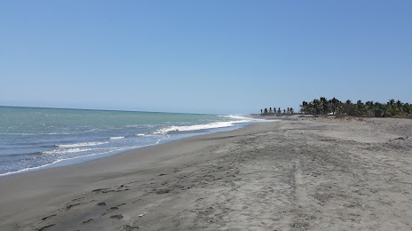
Bahía de Petacalco on the map, Lázaro Cárdenas, Mexico
Photo
Where is located Bahía de Petacalco
Bahía de Petacalco — local attraction, which is located at no data and belongs to the category — -. Average visitor rating for this place — 4.3 (according to 182 ratings, information from open sources and relevant for 2022).
Exact location — Bahía de Petacalco, marked on the map with a red marker.
You can get directions to Bahía de Petacalco on the map from your location.
What else is interesting in Lázaro Cárdenas? You can see all the sights if you go to the city page.
Coordinates
Bahía de Petacalco, Mexico coordinates in decimal format: latitude — 17.969384862991273, longitude — -102.20235227556594. When converted to degrees, minutes, seconds Bahía de Petacalco has the following coordinates: 17°58′9.79 north latitude and -102°12′8.47 east longitude.
Nearby cities
The largest cities that are located nearby:
- Uruapan — 161 km
- Colima — 214 km
- Morelia — 220 km
- Zamora — 225 km
- Manzanillo — 258 km
- Acapulco — 273 km
- Iguala — 282 km
- Chilpancingo — 287 km
- Toluca — 303 km
- Salamanca — 306 km
- Metepec — 306 km
- Irapuato — 313 km
- Tonalá — 314 km
- Celaya — 318 km
- Tlaquepaque — 318 km
- Guadalajara — 322 km
- Zapopan — 326 km
- Cuernavaca — 329 km
- Jiutepec — 331 km
Distance to the capital
Distance to the capital (Mexico City) is about — 362 km.