 Bel-Ha
San Jose El Alto
El Porvenir
Nueva Palestina
Santa Lucía
Chemax
La Morita
Temoac
Zacualpan
Bel-Ha
San Jose El Alto
El Porvenir
Nueva Palestina
Santa Lucía
Chemax
La Morita
Temoac
Zacualpan
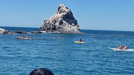
Isla San Jorge on the map, Puerto Peñasco, Mexico
Photo
Where is located Isla San Jorge
Isla San Jorge — local attraction, which is located at no data and belongs to the category — -. Average visitor rating for this place — 4.5 (according to 8 ratings, information from open sources and relevant for 2022).
Exact location — Isla San Jorge, marked on the map with a red marker.
You can get directions to Isla San Jorge on the map from your location.
What else is interesting in Puerto Peñasco? You can see all the sights if you go to the city page.
Coordinates
Isla San Jorge, Mexico coordinates in decimal format: latitude — 31.344648843871017, longitude — -113.64127573114293. When converted to degrees, minutes, seconds Isla San Jorge has the following coordinates: 31°20′40.74 north latitude and -113°38′28.59 east longitude.
Nearby cities
The largest cities that are located nearby:
- San Luis Río Colorado — 170 km
- Mexicali — 229 km
- Nogales
 (United States) — 245 km
 - Tucson (United States) — 263 km
- Chandler (United States) — 269 km
- Phoenix (United States) — 270 km
- Glendale (United States) — 274 km
- Tempe (United States) — 275 km
- Gilbert (United States) — 276 km
- Peoria (United States) — 276 km
- Mesa (United States) — 279 km
- Scottsdale (United States) — 282 km
- Ensenada — 295 km
- Hermosillo — 352 km
- Tijuana — 352 km
- Chula Vista (United States) — 361 km
- San Diego (United States) — 371 km
- Escondido (United States) — 384 km
- Oceanside (United States) — 412 km
Distance to the capital
Distance to the capital (Mexico City) is about — 1966 km.