 Bel-Ha
San Jose El Alto
El Porvenir
Nueva Palestina
Santa Lucía
Chemax
La Morita
Temoac
Zacualpan
Bel-Ha
San Jose El Alto
El Porvenir
Nueva Palestina
Santa Lucía
Chemax
La Morita
Temoac
Zacualpan
Playa El Bebe on the map, Rosarito, Mexico
Photo
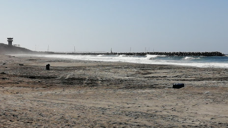
Where is located Playa El Bebe
Playa El Bebe — local attraction, which is located at no data and belongs to the category — -. Average visitor rating for this place — 4.2 (according to 307 ratings, information from open sources and relevant for 2022).
Exact location — Playa El Bebe, marked on the map with a red marker.
You can get directions to Playa El Bebe on the map from your location.
What else is interesting in Rosarito? You can see all the sights if you go to the city page.
Coordinates
Playa El Bebe, Mexico coordinates in decimal format: latitude — 32.3751920394735, longitude — -117.07692932949523. When converted to degrees, minutes, seconds Playa El Bebe has the following coordinates: 32°22′30.69 north latitude and -117°4′36.95 east longitude.
Nearby cities
The largest cities that are located nearby:
- Tijuana — 19 km
- Chula Vista
 (United States) — 33 km
 - San Diego (United States) — 42 km
- Ensenada — 68 km
- Escondido (United States) — 86 km
- Oceanside (United States) — 99 km
- Mexicali — 153 km
- Irvine (United States) — 163 km
- Costa Mesa (United States) — 164 km
- Huntington Beach (United States) — 170 km
- Santa Ana (United States) — 172 km
- Orange (United States) — 176 km
- Corona (United States) — 176 km
- Moreno Valley (United States) — 178 km
- Garden Grove (United States) — 178 km
- Riverside (United States) — 181 km
- Anaheim (United States) — 183 km
- Fullerton (United States) — 187 km
- Long Beach (United States) — 189 km
Distance to the capital
Distance to the capital (Mexico City) is about — 2295 km.