
 Bel-Ha
San Jose El Alto
El Porvenir
Nueva Palestina
Santa Lucía
Chemax
La Morita
Temoac
Zacualpan
Bel-Ha
San Jose El Alto
El Porvenir
Nueva Palestina
Santa Lucía
Chemax
La Morita
Temoac
Zacualpan
Balneario Los Arcos Ejido Puruándiro on the map, Puruándiro, Mexico
Photo
Where is located Balneario Los Arcos Ejido Puruándiro
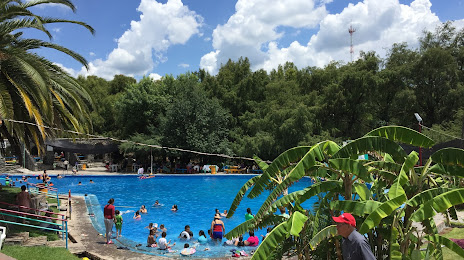
Balneario Los Arcos Ejido Puruándiro — local attraction, which is located at Carretera Puruándiro Cuitzeo, Km. 3, Los Conos, 58503 Puruándiro, Mich., Mexico and belongs to the category — water park. Average visitor rating for this place — 4.3 (according to 578 ratings, information from open sources and relevant for 2022).
Exact location — Balneario Los Arcos Ejido Puruándiro, marked on the map with a red marker.
You can get directions to Balneario Los Arcos Ejido Puruándiro on the map from your location.
What else is interesting in Puruándiro? You can see all the sights if you go to the city page.
Coordinates
Balneario Los Arcos Ejido Puruándiro, Mexico coordinates in decimal format: latitude — 20.087380343622655, longitude — -101.49097507553348. When converted to degrees, minutes, seconds Balneario Los Arcos Ejido Puruándiro has the following coordinates: 20°5′14.57 north latitude and -101°29′27.51 east longitude.
Nearby cities
The largest cities that are located nearby:
- Morelia — 54 km
- Salamanca — 62 km
- Irapuato — 67 km
- Zamora — 80 km
- Celaya — 88 km
- Uruapan — 93 km
- León — 116 km
- Santiago de Querétaro — 129 km
- San Juan del Río — 162 km
- Tonalá — 188 km
- Tlaquepaque — 196 km
- Guadalajara — 200 km
- Zapopan — 207 km
- Toluca — 214 km
- Aguascalientes — 214 km
- Metepec — 220 km
- San Luis Potosi — 235 km
- Soledad de Graciano Sánchez — 239 km
- Cuautitlán Izcalli — 241 km
Distance to the capital
Distance to the capital (Mexico City) is about — 257 km.