
 Bel-Ha
San Jose El Alto
El Porvenir
Nueva Palestina
Santa Lucía
Chemax
La Morita
Temoac
Zacualpan
Bel-Ha
San Jose El Alto
El Porvenir
Nueva Palestina
Santa Lucía
Chemax
La Morita
Temoac
Zacualpan
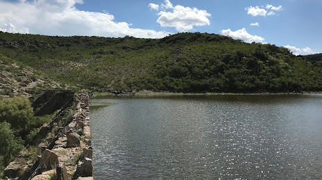
Presa Los Arquitos on the map, Jesús María, Mexico
Photo
Where is located Presa Los Arquitos
Presa Los Arquitos — local attraction, which is located at no data and belongs to the category — -. Average visitor rating for this place — 4.4 (according to 46 ratings, information from open sources and relevant for 2022).
Exact location — Presa Los Arquitos, marked on the map with a red marker.
You can get directions to Presa Los Arquitos on the map from your location.
What else is interesting in Jesús María? You can see all the sights if you go to the city page.
Coordinates
Presa Los Arquitos, Mexico coordinates in decimal format: latitude — 21.925153916501035, longitude — -102.39377715599784. When converted to degrees, minutes, seconds Presa Los Arquitos has the following coordinates: 21°55′30.55 north latitude and -102°23′37.6 east longitude.
Nearby cities
The largest cities that are located nearby:
- Aguascalientes — 11 km
- Zacatecas — 92 km
- León — 116 km
- San Luis Potosi — 141 km
- Fresnillo — 144 km
- Soledad de Graciano Sánchez — 146 km
- Tonalá — 175 km
- Irapuato — 176 km
- Tlaquepaque — 177 km
- Guadalajara — 178 km
- Zapopan — 181 km
- Salamanca — 195 km
- Zamora — 219 km
- Celaya — 225 km
- Santiago de Querétaro — 254 km
- Tepic — 267 km
- Morelia — 277 km
- Uruapan — 285 km
- San Juan del Río — 301 km
Distance to the capital
Distance to the capital (Mexico City) is about — 438 km.