
 Bel-Ha
San Jose El Alto
El Porvenir
Nueva Palestina
Santa Lucía
Chemax
La Morita
Temoac
Zacualpan
Bel-Ha
San Jose El Alto
El Porvenir
Nueva Palestina
Santa Lucía
Chemax
La Morita
Temoac
Zacualpan
Mina El Edén on the map, Zacatecas, Mexico
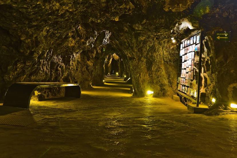
Photo
Where is located Mina El Edén
Mina El Edén — local attraction, which is located at Mina del Edén, Antonio Dovali Jaime S/N, Zacatecas Centro, 98000 Zacatecas, Zac., Mexico and belongs to the category — tourist attraction. Average visitor rating for this place — 4.8 (according to 2819 ratings, information from open sources and relevant for 2022).
Exact location — Mina El Edén, marked on the map with a red marker.
You can get directions to Mina El Edén on the map from your location.
What else is interesting in Zacatecas? You can see all the sights if you go to the city page.
Coordinates
Mina El Edén, Mexico coordinates in decimal format: latitude — 22.776764170168708, longitude — -102.57984477548727. When converted to degrees, minutes, seconds Mina El Edén has the following coordinates: 22°46′36.35 north latitude and -102°34′47.44 east longitude.
Nearby cities
The largest cities that are located nearby:
- Fresnillo — 53 km
- Aguascalientes — 102 km
- San Luis Potosi — 177 km
- Soledad de Graciano Sánchez — 180 km
- León — 204 km
- Guadalajara — 247 km
- Tonalá — 247 km
- Tlaquepaque — 247 km
- Zapopan — 248 km
- Durango — 251 km
- Irapuato — 264 km
- Tepic — 276 km
- Salamanca — 283 km
- Celaya — 308 km
- Zamora — 309 km
- Matamoros — 311 km
- Torreón — 317 km
- Gómez Palacio — 324 km
- Santiago de Querétaro — 331 km
Distance to the capital
Distance to the capital (Mexico City) is about — 516 km.