
 Bel-Ha
San Jose El Alto
El Porvenir
Nueva Palestina
Santa Lucía
Chemax
La Morita
Temoac
Zacualpan
Bel-Ha
San Jose El Alto
El Porvenir
Nueva Palestina
Santa Lucía
Chemax
La Morita
Temoac
Zacualpan
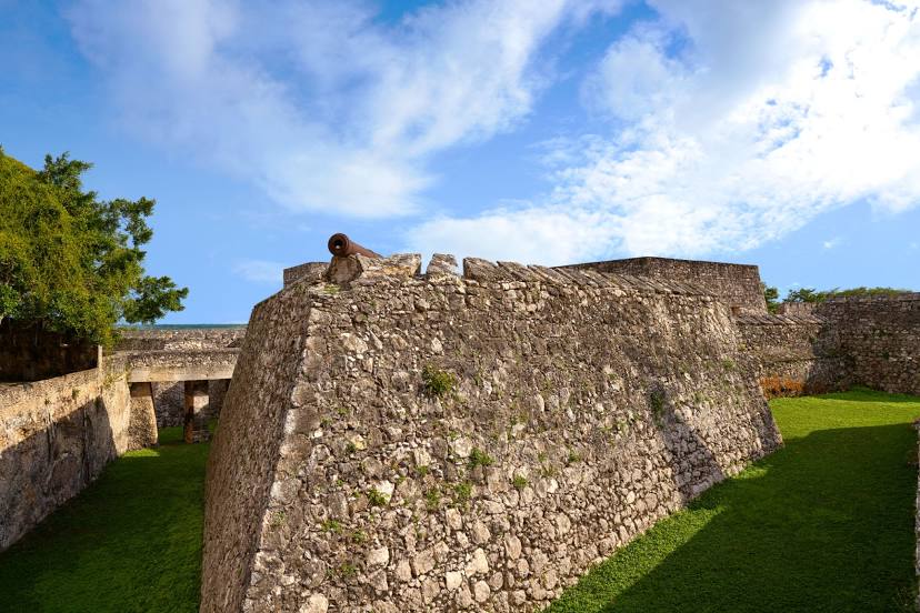
Fuerte de San Felipe de Bacalar on the map, Bacalar, Mexico
Photo
Where is located Fuerte de San Felipe de Bacalar
Fuerte de San Felipe de Bacalar — local attraction, which is located at Av 3, Centro, 77930 Bacalar, Q.R., Mexico and belongs to the category — fortress. Average visitor rating for this place — 4.6 (according to 11723 ratings, information from open sources and relevant for 2022).
Exact location — Fuerte de San Felipe de Bacalar, marked on the map with a red marker.
You can get directions to Fuerte de San Felipe de Bacalar on the map from your location.
What else is interesting in Bacalar? You can see all the sights if you go to the city page.
Coordinates
Fuerte de San Felipe de Bacalar, Mexico coordinates in decimal format: latitude — 18.676954450015856, longitude — -88.38860657555546. When converted to degrees, minutes, seconds Fuerte de San Felipe de Bacalar has the following coordinates: 18°40′37.04 north latitude and -88°23′18.98 east longitude.
Nearby cities
The largest cities that are located nearby:
- Chetumal — 22 km
- Campeche — 257 km
- Merida — 282 km
- Cancún — 317 km
- Choloma
 (Honduras) — 344 km
 - San Pedro Sula (Honduras) — 353 km
- Ciudad del Carmen — 358 km
- La Ceiba (Honduras) — 362 km
- El Progreso (Honduras) — 368 km
- Villahermosa — 485 km
- San Cristóbal de las Casas — 498 km
- San Juan Sacatepéquez
 (Guatemala) — 500 km
 - Guatemala City (Guatemala) — 505 km
- Villa Nueva (Guatemala) — 516 km
- Villa Canales (Guatemala) — 517 km
- Tegucigalpa (Honduras) — 523 km
- Santa Ana
 (El Salvador) — 535 km
 - Quetzaltenango (Guatemala) — 541 km
- Tuxtla Gutiérrez — 542 km
Distance to the capital
Distance to the capital (Mexico City) is about — 1133 km.