 Taxisco
Jacaltenango
Poptún
Santo Domingo Suchitepéquez
Champerico
Sipacapa
San Pedro La Laguna
San Antonio Suchitepéquez
Cubulco
Esquipulas
Chicacao
Mazatenango
San Juan Ostuncalco
Amatitlán
Santa María de Jesús
Casillas
Guatemala
Parramos
El Palmar
Taxisco
Jacaltenango
Poptún
Santo Domingo Suchitepéquez
Champerico
Sipacapa
San Pedro La Laguna
San Antonio Suchitepéquez
Cubulco
Esquipulas
Chicacao
Mazatenango
San Juan Ostuncalco
Amatitlán
Santa María de Jesús
Casillas
Guatemala
Parramos
El Palmar
Santa Lucía Cotzumalguapa on the map, Guatemala
Where is located Santa Lucía Cotzumalguapa
Exact location — Santa Lucía Cotzumalguapa, Escuintla, Guatemala, marked on the map with a red marker.
Coordinates
Santa Lucía Cotzumalguapa, Guatemala coordinates in decimal format: latitude — 14.333333, longitude — -91.016667. When converted to degrees, minutes, seconds Santa Lucía Cotzumalguapa has the following coordinates: 14°19′60 north latitude and -91°1′0 east longitude.
Population
Santa Lucía Cotzumalguapa, Escuintla, Guatemala, according to our data the population is — 60,821 residents, which is about 0.3% of the total population of the country (Guatemala).
Comparison of the population on the graph:
Exact time
Time zone for this location Santa Lucía Cotzumalguapa — UTC -6 America/Guatemala. Exact time — friday, 4 april 2024 year, 15 h. 36 minutes.
Sunrise and sunset
Santa Lucía Cotzumalguapa, sunrise and sunset data for a date — friday 19.04.2024.
| Sunrise | Sunset | Day (duration) |
|---|---|---|
| 05:49 -1 minute | 18:16 +1 minute | 12 h. 30 minutes. +2 minutes |
You can control the scale of the map using the auxiliary tools to find out exactly where it is located Santa Lucía Cotzumalguapa. When you change the scale of the map, the width of the ruler also changes (in kilometers and miles).
Nearby cities
The largest cities that are located nearby:
- Escuintla — 25 km
- Villa Nueva — 51 km
- Villa Canales — 56 km
- San Juan Sacatepéquez — 58 km
- Quetzaltenango — 77 km
- Tapachula
 (Mexico) — 147 km
 - Santa Ana
 (El Salvador) — 161 km
 - Santa Tecla (El Salvador) — 199 km
- Mejicanos (El Salvador) — 205 km
- Apopa (El Salvador) — 206 km
- San Salvador (El Salvador) — 206 km
- Soyapango (El Salvador) — 213 km
- San Cristóbal de las Casas (Mexico) — 316 km
- San Miguel (El Salvador) — 319 km
- San Pedro Sula
 (Honduras) — 343 km
 - Tuxtla Gutiérrez (Mexico) — 347 km
- Choloma (Honduras) — 356 km
- El Progreso (Honduras) — 363 km
- Tegucigalpa (Honduras) — 408 km
Distance to neighboring capitals:
- San Salvador (El Salvador) — 207 km
- Belmopan
 (Belize) — 404 km
 - Tegucigalpa (Honduras) — 411 km
- Managua
 (Nicaragua) — 571 km
 - Mexico City (Mexico) — 1033 km
- Washington
 (United States) — 3058 km
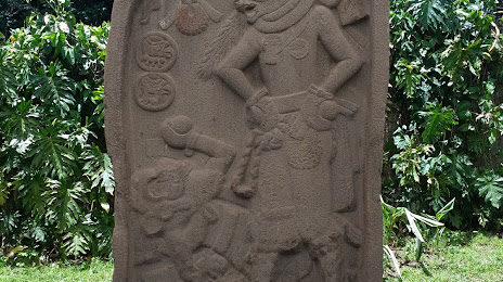
Attractions
Distance to the capital
Distance to the capital (Guatemala City) is about — 60 km.