Seròs — La Matanza de Acentejo
Seròs — Porcuna
Seròs — La Bisbal del Penedès
Seròs — Ogueta
Seròs — Càlig
Seròs — Bérchules
Seròs — Bogarra
Seròs — Argamasilla de Alba
Seròs — Moraleja
Seròs — Riudellots de la Selva
Seròs — Fuente Álamo
Seròs — Cales de Mallorca
Seròs — Arlegui
Seròs — Navahermosa
Seròs — Villaviciosa
Seròs — Cigales DO
Seròs — Murieta
Seròs — Morales
Seròs — Tamariu
Soses
Torres de Segre
Sudanell
Albatàrrec
Alfés
Artesa de Lleida
Puigverd de Lleida
Castelldans
Juneda
Les Borges Blanques
Cervià de les Garrigues
Vinaixa
Tarrés
Vimbodí
L'Espluga de Francolí
Montblanc
La Riba
Alcover
Almoster
Castellvell del Camp
Reus
Vila-seca
Seròs — La Matanza de Acentejo
Seròs — Porcuna
Seròs — La Bisbal del Penedès
Seròs — Ogueta
Seròs — Càlig
Seròs — Bérchules
Seròs — Bogarra
Seròs — Argamasilla de Alba
Seròs — Moraleja
Seròs — Riudellots de la Selva
Seròs — Fuente Álamo
Seròs — Cales de Mallorca
Seròs — Arlegui
Seròs — Navahermosa
Seròs — Villaviciosa
Seròs — Cigales DO
Seròs — Murieta
Seròs — Morales
Seròs — Tamariu
Soses
Torres de Segre
Sudanell
Albatàrrec
Alfés
Artesa de Lleida
Puigverd de Lleida
Castelldans
Juneda
Les Borges Blanques
Cervià de les Garrigues
Vinaixa
Tarrés
Vimbodí
L'Espluga de Francolí
Montblanc
La Riba
Alcover
Almoster
Castellvell del Camp
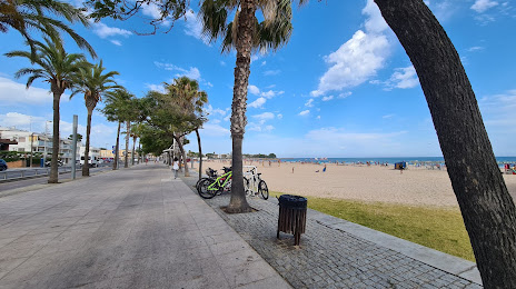
Reus
Vila-seca
Seròs — Cambrils distance, route on the map
Distance by car
Distance between Seròs, Catalunya, Spain and Cambrils, Catalunya, Spain by car is — km, or miles. To travel this distance by car, you need minute, or h.
Route on the map, driving directions
Car route Seròs — Cambrils was created automatically. The road on the map is shown as a blue line. By moving the markers, you can create a new route through the points you need.
Passing cities through which the car route passes: Aitona, Soses, Torres de Segre, Sudanell, Albatàrrec, Alfés, Artesa de Lleida, Puigverd de Lleida, Castelldans, Juneda, Les Borges Blanques, Cervià de les Garrigues, Vinaixa, Tarrés, Vimbodí, L'Espluga de Francolí, Montblanc, La Riba, Alcover, Almoster, Castellvell del Camp, Reus, Vila-seca.
Distance by plane
If you decide to take a trip Seròs Cambrils by plane, then you have to fly the distance — 70 km or 43 miles. It is marked on the map with a gray line (between two points in a straight line).
Flight time
Estimated flight time Seròs Cambrils by plane at cruising speed 750 km / h will be — 5 min.
Direction of movement
Spain, Seròs — right-hand traffic. Spain, Cambrils — right-hand traffic.
Difference in time
Seròs and Cambrils are in the same time zone. Between them there is no time difference (UTC +2 Europe/Madrid).
Interesting Facts
Information on alternative ways to get to your destination.
The length of this distance is about 0.2% of the total length of the equator.
The percentage of the population is clearly shown in the graph:
Seròs — 1,881 (less by 21,952), Cambrils — 23,833 residents.
The cost of travel
Calculate the cost of the trip yourself using the fuel consumption calculator, changing the data in the table.