
Other locations
Aki  Itoshima
Saikai
Izumi
Ichikikushikino
Uruma
Kirishima
Kunisaki
Bungotakada
Gotsu
Itoshima
Saikai
Izumi
Ichikikushikino
Uruma
Kirishima
Kunisaki
Bungotakada
Gotsu
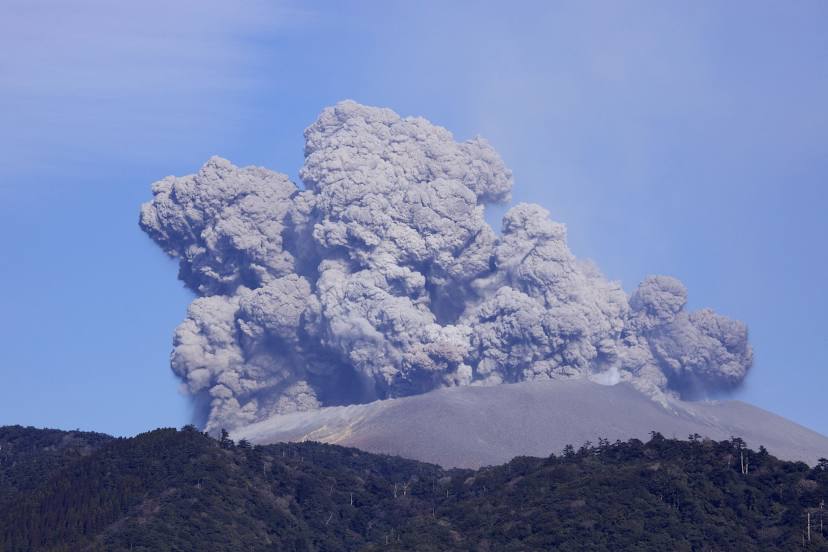
Shinmoedake on the map, Kobayashi, Japan
Comments
Where is located Shinmoedake on the map, Kobayashi, Japan. Geographic coordinates in decimal format, as well as degrees, minutes and seconds. Photo, address and average rating of visitors who have been here.
Photo
Where is located Shinmoedake
Shinmoedake — local attraction, which is located at 1,421 m and belongs to the category — -. Average visitor rating for this place — 3.9 (according to 87 ratings, information from open sources and relevant for 2022).
Exact location — Shinmoedake, marked on the map with a red marker.
You can get directions to Shinmoedake on the map from your location.
What else is interesting in Kobayashi? You can see all the sights if you go to the city page.
Coordinates
Shinmoedake, Japan coordinates in decimal format: latitude — 32.02735948315199, longitude — 131.03156366346286. When converted to degrees, minutes, seconds Shinmoedake has the following coordinates: 32°1′38.49 north latitude and 131°1′53.63 east longitude.
Nearby cities
The largest cities that are located nearby:
- Miyakonojo — 32 km
- Miyazaki — 43 km
- Kagoshima — 59 km
- Yatsushiro — 66 km
- Nobeoka — 91 km
- Kumamoto — 92 km
- Omuta — 124 km
- Nagasaki — 132 km
- Oita — 149 km
- Beppu — 150 km
- Kurume — 152 km
- Sasebo — 175 km
- Fukuoka — 184 km
- Kitakyushu — 209 km
- Ube — 218 km
- Hofu — 234 km
- Yamaguchi — 246 km
- Matsuyama — 262 km
- Iwakuni — 266 km