
Other locations
Aki  Itoshima
Saikai
Izumi
Ichikikushikino
Uruma
Kirishima
Kunisaki
Bungotakada
Gotsu
Itoshima
Saikai
Izumi
Ichikikushikino
Uruma
Kirishima
Kunisaki
Bungotakada
Gotsu
Oto Island on the map, Nobeoka, Japan
Comments
Where is located Oto Island on the map, Nobeoka, Japan. Geographic coordinates in decimal format, as well as degrees, minutes and seconds. Photo, address and average rating of visitors who have been here.
Photo
Where is located Oto Island
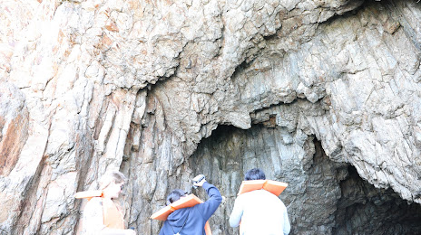
Oto Island — local attraction, which is located at no data and belongs to the category — -. Average visitor rating for this place — 4.5 (according to 4 ratings, information from open sources and relevant for 2022).
Exact location — Oto Island, marked on the map with a red marker.
You can get directions to Oto Island on the map from your location.
What else is interesting in Nobeoka? You can see all the sights if you go to the city page.
Coordinates
Oto Island, Japan coordinates in decimal format: latitude — 32.465946615670646, longitude — 131.6677834706522. When converted to degrees, minutes, seconds Oto Island has the following coordinates: 32°27′57.41 north latitude and 131°40′4.02 east longitude.
Nearby cities
The largest cities that are located nearby:
- Oita — 73 km
- Miyazaki — 78 km
- Beppu — 79 km
- Kumamoto — 92 km
- Yatsushiro — 99 km
- Miyakonojo — 111 km
- Omuta — 123 km
- Kurume — 134 km
- Kagoshima — 151 km
- Ube — 156 km
- Kitakyushu — 161 km
- Fukuoka — 161 km
- Hofu — 163 km
- Nagasaki — 167 km
- Matsuyama — 172 km
- Yamaguchi — 177 km
- Iwakuni — 182 km
- Sasebo — 192 km
- Kure — 202 km