
 Itoshima
Saikai
Izumi
Ichikikushikino
Uruma
Kirishima
Kunisaki
Bungotakada
Gotsu
Itoshima
Saikai
Izumi
Ichikikushikino
Uruma
Kirishima
Kunisaki
Bungotakada
Gotsu
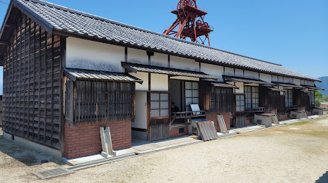
田川市石炭・歴史博物館 on the map, Tagawa, Japan
Photo
Where is located 田川市石炭・歴史博物館
田川市石炭・歴史博物館 — local attraction, which is located at 2734-1 Ita, Tagawa, Fukuoka 825-0002, Japan and belongs to the category — local history museum. Average visitor rating for this place — 4.1 (according to 341 rating, information from open sources and relevant for 2022).
Exact location — 田川市石炭・歴史博物館, marked on the map with a red marker.
You can get directions to 田川市石炭・歴史博物館 on the map from your location.
What else is interesting in Tagawa? You can see all the sights if you go to the city page.
Coordinates
田川市石炭・歴史博物館, Japan coordinates in decimal format: latitude — 33.64079308652302, longitude — 130.81382452475364. When converted to degrees, minutes, seconds 田川市石炭・歴史博物館 has the following coordinates: 33°38′26.86 north latitude and 130°48′49.77 east longitude.
Nearby cities
The largest cities that are located nearby:
- Kitakyushu — 28 km
- Fukuoka — 38 km
- Kurume — 45 km
- Ube — 53 km
- Beppu — 74 km
- Omuta — 75 km
- Hofu — 83 km
- Yamaguchi — 85 km
- Oita — 86 km
- Kumamoto — 93 km
- Sasebo — 113 km
- Yatsushiro — 127 km
- Nagasaki — 131 km
- Nobeoka — 142 km
- Iwakuni — 142 km
- Hiroshima — 172 km
- Kure — 174 km
- Matsuyama — 181 km
- Miyazaki — 200 km