
 Puerto de la Duquesa
La Serna de Iguña
Pumalverde
Puentenansa
La Iglesia
Casar de Periedo
Fuengirola
Renedo de Piélagos
Villabanez
Puerto de la Duquesa
La Serna de Iguña
Pumalverde
Puentenansa
La Iglesia
Casar de Periedo
Fuengirola
Renedo de Piélagos
Villabanez
Parque Natural de Corralejo on the map, Corralejo, Spain
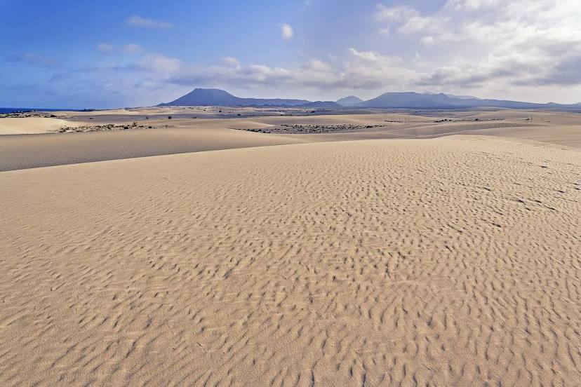
Photo
Where is located Parque Natural de Corralejo
Parque Natural de Corralejo — local attraction, which is located at Spain and belongs to the category — nature preserve. Average visitor rating for this place — 4.8 (according to 5981 rating, information from open sources and relevant for 2022).
Exact location — Parque Natural de Corralejo, marked on the map with a red marker.
You can get directions to Parque Natural de Corralejo on the map from your location.
What else is interesting in Corralejo? You can see all the sights if you go to the city page.
Coordinates
Parque Natural de Corralejo, Spain coordinates in decimal format: latitude — 28.682968727109152, longitude — -13.850675275366862. When converted to degrees, minutes, seconds Parque Natural de Corralejo has the following coordinates: 28°40′58.69 north latitude and -13°51′2.43 east longitude.
Nearby cities
The largest cities that are located nearby:
- Las Palmas de Gran Canaria — 167 km
- Telde — 172 km
- Santa Cruz de Tenerife — 234 km
- Agadir
 (Morocco) — 448 km
 - Essaouira (Morocco) — 494 km
- Safi (Morocco) — 586 km
- Marrakesh (Morocco) — 638 km
- Ouarzazate (Morocco) — 701 km
- El Jadida (Morocco) — 703 km
- Azilal (Morocco) — 772 km
- Casablanca (Morocco) — 788 km
- Khouribga (Morocco) — 792 km
- Mohammedia (Morocco) — 810 km
- Temara (Morocco) — 859 km
- Sale (Morocco) — 876 km
- Khenifra (Morocco) — 892 km
- Kenitra (Morocco) — 903 km
- Khemisset (Morocco) — 911 km
- Meknes (Morocco) — 953 km
Distance to the capital
Distance to the capital (Madrid) is about — 1600 km.