
 Józefów nad Wisłą
Gorzyce Wielkie
Rogówek
Sromowce Niżne
Wyszków County
Kruszewo
Jantar
Sady Górne
Nagoszewo
Józefów nad Wisłą
Gorzyce Wielkie
Rogówek
Sromowce Niżne
Wyszków County
Kruszewo
Jantar
Sady Górne
Nagoszewo
Miejski Park Solidarności w Ełku on the map, Elk, Poland
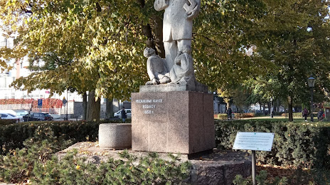
Photo
Where is located Miejski Park Solidarności w Ełku
Miejski Park Solidarności w Ełku — local attraction, which is located at Park Solidarności, Jana i Hieronima Małeckich, 19-300 Ełk, Poland and belongs to the category — state park. Average visitor rating for this place — 4.4 (according to 265 ratings, information from open sources and relevant for 2022).
Exact location — Miejski Park Solidarności w Ełku, marked on the map with a red marker.
You can get directions to Miejski Park Solidarności w Ełku on the map from your location.
What else is interesting in Elk? You can see all the sights if you go to the city page.
Coordinates
Miejski Park Solidarności w Ełku, Poland coordinates in decimal format: latitude — 53.823753881945386, longitude — 22.351199425405902. When converted to degrees, minutes, seconds Miejski Park Solidarności w Ełku has the following coordinates: 53°49′25.51 north latitude and 22°21′4.32 east longitude.
Nearby cities
The largest cities that are located nearby:
- Bialystok — 94 km
- Olsztyn — 123 km
- Kaunas
 (Lithuania) — 154 km
 - Kaliningrad
 (Russia) — 154 km
 - Elblag — 195 km
- Vilnius (Lithuania) — 209 km
- Brest
 (Belarus) — 213 km
 - Klaipėda (Lithuania) — 221 km
- Plock — 228 km
- Šiauliai (Lithuania) — 240 km
- Panevėžys (Lithuania) — 245 km
- Gdańsk — 246 km
- Baranovichi (Belarus) — 254 km
- Wloclawek — 257 km
- Gdynia — 258 km
- Torun — 266 km
- Radom — 281 km
- Lublin — 286 km
- Maladzyechna (Belarus) — 294 km
Distance to the capital
Distance to the capital (Warsaw) is about — 199 km.