
 Puerto de la Duquesa
La Serna de Iguña
Pumalverde
Puentenansa
La Iglesia
Casar de Periedo
Fuengirola
Renedo de Piélagos
Villabanez
Puerto de la Duquesa
La Serna de Iguña
Pumalverde
Puentenansa
La Iglesia
Casar de Periedo
Fuengirola
Renedo de Piélagos
Villabanez
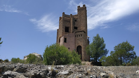
Castillo de la Mota on the map, Coín, Spain
Photo
Where is located Castillo de la Mota
Castillo de la Mota — local attraction, which is located at Urbanizacion UR9, 39, 29120 Alhaurín el Grande, Málaga, Spain and belongs to the category — tourist attraction. Average visitor rating for this place — 4.1 (according to 219 ratings, information from open sources and relevant for 2022).
Exact location — Castillo de la Mota, marked on the map with a red marker.
You can get directions to Castillo de la Mota on the map from your location.
What else is interesting in Coín? You can see all the sights if you go to the city page.
Coordinates
Castillo de la Mota, Spain coordinates in decimal format: latitude — 36.62083883063156, longitude — -4.710443875165722. When converted to degrees, minutes, seconds Castillo de la Mota has the following coordinates: 36°37′15.02 north latitude and -4°42′37.6 east longitude.
Nearby cities
The largest cities that are located nearby:
- Marbella — 20 km
- Málaga — 24 km
- Algeciras — 85 km
- Granada — 117 km
- Jerez — 121 km
- Dos Hermanas — 124 km
- Tetouan
 (Morocco) — 133 km
 - Córdoba — 136 km
- Cádiz — 137 km
- Tangier (Morocco) — 139 km
- Jaén — 150 km
- Huelva — 204 km
- Almería — 204 km
- Nador (Morocco) — 233 km
- Taounate (Morocco) — 235 km
- Taza (Morocco) — 279 km
- Badajoz — 311 km
- Meknes (Morocco) — 315 km
- Kenitra (Morocco) — 315 km
Distance to the capital
Distance to the capital (Madrid) is about — 431 km.