
 Puerto de la Duquesa
La Serna de Iguña
Pumalverde
Puentenansa
La Iglesia
Casar de Periedo
Fuengirola
Renedo de Piélagos
Villabanez
Puerto de la Duquesa
La Serna de Iguña
Pumalverde
Puentenansa
La Iglesia
Casar de Periedo
Fuengirola
Renedo de Piélagos
Villabanez
Playa Els Tossals on the map, Guardamar del Segura, Spain
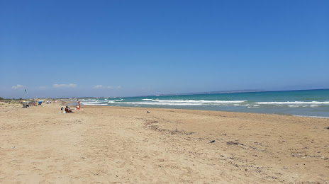
Photo
Where is located Playa Els Tossals
Playa Els Tossals — local attraction, which is located at Alicante and belongs to the category — -. Average visitor rating for this place — 4.5 (according to 201 rating, information from open sources and relevant for 2022).
Exact location — Playa Els Tossals, marked on the map with a red marker.
You can get directions to Playa Els Tossals on the map from your location.
What else is interesting in Guardamar del Segura? You can see all the sights if you go to the city page.
Coordinates
Playa Els Tossals, Spain coordinates in decimal format: latitude — 38.123357904152726, longitude — -0.6406916194535005. When converted to degrees, minutes, seconds Playa Els Tossals has the following coordinates: 38°7′24.09 north latitude and -0°38′26.49 east longitude.
Nearby cities
The largest cities that are located nearby:
- Murcia — 43 km
- Cartagena — 59 km
- Albacete — 144 km
- Valencia — 155 km
- Almería — 212 km
- Oran
 (Algeria) — 264 km
 - Jaén — 276 km
- Chlef (Algeria) — 276 km
- Granada — 278 km
- Relizane (Algeria) — 281 km
- Sidi Bel Abbes (Algeria) — 319 km
- Palma — 326 km
- Alcala de Henares — 350 km
- Torrejón de Ardoz — 354 km
- Getafe — 358 km
- Algiers (Algeria) — 359 km
- Tlemcen (Algeria) — 359 km
- Fuenlabrada — 361 km
- Córdoba — 361 km
Distance to the capital
Distance to the capital (Madrid) is about — 367 km.