
 Puerto de la Duquesa
La Serna de Iguña
Pumalverde
Puentenansa
La Iglesia
Casar de Periedo
Fuengirola
Renedo de Piélagos
Villabanez
Puerto de la Duquesa
La Serna de Iguña
Pumalverde
Puentenansa
La Iglesia
Casar de Periedo
Fuengirola
Renedo de Piélagos
Villabanez
Cala Montgó on the map, Torroella de Montgrí, Spain
Photo
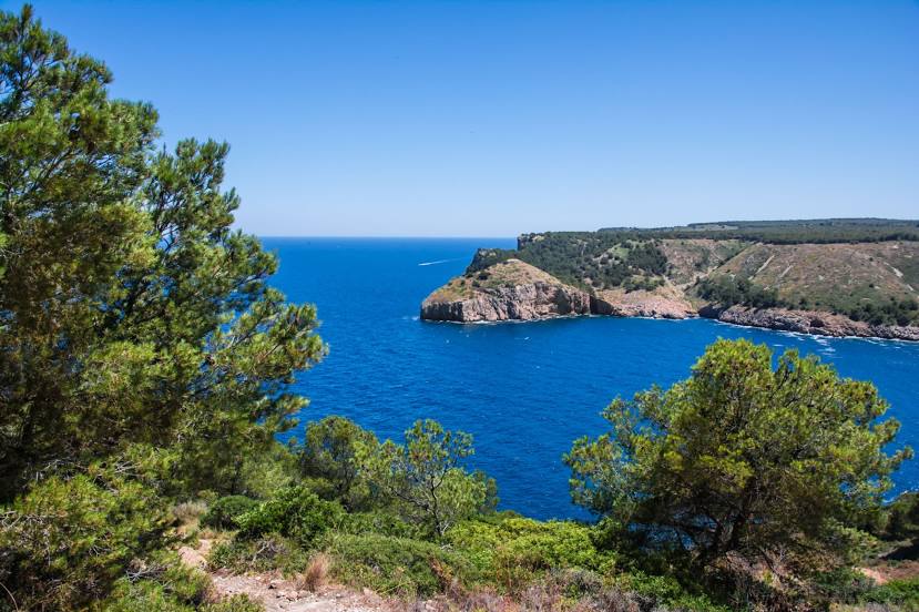
Where is located Cala Montgó
Cala Montgó — local attraction, which is located at no data and belongs to the category — -. Average visitor rating for this place — 4.6 (according to 301 rating, information from open sources and relevant for 2022).
Exact location — Cala Montgó, marked on the map with a red marker.
You can get directions to Cala Montgó on the map from your location.
What else is interesting in Torroella de Montgrí? You can see all the sights if you go to the city page.
Coordinates
Cala Montgó, Spain coordinates in decimal format: latitude — 42.0736957244578, longitude — 3.1667771250654075. When converted to degrees, minutes, seconds Cala Montgó has the following coordinates: 42°4′25.3 north latitude and 3°10′0.4 east longitude.
Nearby cities
The largest cities that are located nearby:
- Perpignan
 (France) — 74 km
 - Mataró — 79 km
- Badalona — 98 km
- Sabadell — 100 km
- Santa Coloma de Gramenet — 101 km
- Terrassa — 107 km
- L'Hospitalet de Llobregat — 112 km
- Montpellier (France) — 184 km
- Tarragona — 187 km
- Lleida — 212 km
- Toulouse (France) — 219 km
- Nimes (France) — 221 km
- Marseille (France) — 228 km
- Aix-en-Provence (France) — 248 km
- Toulon (France) — 256 km
- Palma — 276 km
- Zaragoza — 335 km
- Nice (France) — 378 km
- Saint-Étienne (France) — 388 km
Distance to the capital
Distance to the capital (Madrid) is about — 603 km.