
 Puerto de la Duquesa
La Serna de Iguña
Pumalverde
Puentenansa
La Iglesia
Casar de Periedo
Fuengirola
Renedo de Piélagos
Villabanez
Puerto de la Duquesa
La Serna de Iguña
Pumalverde
Puentenansa
La Iglesia
Casar de Periedo
Fuengirola
Renedo de Piélagos
Villabanez
Sanlucar Bda.-La Calzada on the map, Sanlúcar de Barrameda, Spain
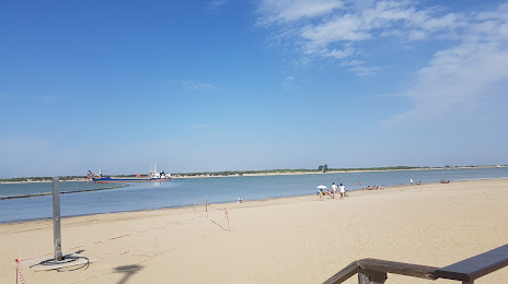
Photo
Where is located Sanlucar Bda.-La Calzada
Sanlucar Bda.-La Calzada — local attraction, which is located at Cádiz and belongs to the category — -. Average visitor rating for this place — 4.4 (according to 225 ratings, information from open sources and relevant for 2022).
Exact location — Sanlucar Bda.-La Calzada, marked on the map with a red marker.
You can get directions to Sanlucar Bda.-La Calzada on the map from your location.
What else is interesting in Sanlúcar de Barrameda? You can see all the sights if you go to the city page.
Coordinates
Sanlucar Bda.-La Calzada, Spain coordinates in decimal format: latitude — 36.78479598317381, longitude — -6.359589821917918. When converted to degrees, minutes, seconds Sanlucar Bda.-La Calzada has the following coordinates: 36°47′5.27 north latitude and -6°21′34.52 east longitude.
Nearby cities
The largest cities that are located nearby:
- Jerez — 22 km
- Cádiz — 28 km
- Dos Hermanas — 68 km
- Huelva — 75 km
- Algeciras — 106 km
- Tangier
 (Morocco) — 121 km
 - Marbella — 134 km
- Tetouan (Morocco) — 160 km
- Málaga — 166 km
- Córdoba — 185 km
- Badajoz — 239 km
- Granada — 247 km
- Jaén — 251 km
- Kenitra (Morocco) — 280 km
- Taounate (Morocco) — 292 km
- Sale (Morocco) — 305 km
- Temara (Morocco) — 319 km
- Lisbon
 (Portugal) — 323 km
 - Meknes (Morocco) — 326 km
Distance to the capital
Distance to the capital (Madrid) is about — 465 km.