
 Puerto de la Duquesa
La Serna de Iguña
Pumalverde
Puentenansa
La Iglesia
Casar de Periedo
Fuengirola
Renedo de Piélagos
Villabanez
Puerto de la Duquesa
La Serna de Iguña
Pumalverde
Puentenansa
La Iglesia
Casar de Periedo
Fuengirola
Renedo de Piélagos
Villabanez
Església de Sant Quirze de Pedret on the map, Berga, Spain
Photo
Where is located Església de Sant Quirze de Pedret
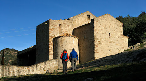
Església de Sant Quirze de Pedret — local attraction, which is located at Camí de Pedret, s/n Oficina de Turisme Berguedà - Carretera C16 Km 96 (Berga, 08698 Cercs, Barcelona, Spain and belongs to the category — church. Average visitor rating for this place — 4.5 (according to 205 ratings, information from open sources and relevant for 2022).
Exact location — Església de Sant Quirze de Pedret, marked on the map with a red marker.
You can get directions to Església de Sant Quirze de Pedret on the map from your location.
What else is interesting in Berga? You can see all the sights if you go to the city page.
Coordinates
Església de Sant Quirze de Pedret, Spain coordinates in decimal format: latitude — 42.10743536099903, longitude — 1.8835846249977333. When converted to degrees, minutes, seconds Església de Sant Quirze de Pedret has the following coordinates: 42°6′26.77 north latitude and 1°53′0.9 east longitude.
Nearby cities
The largest cities that are located nearby:
- Terrassa — 61 km
- Sabadell — 65 km
- Santa Coloma de Gramenet — 79 km
- Badalona — 80 km
- Mataró — 80 km
- L'Hospitalet de Llobregat — 84 km
- Perpignan
 (France) — 107 km
 - Lleida — 114 km
- Tarragona — 120 km
- Toulouse (France) — 169 km
- Zaragoza — 231 km
- Montpellier (France) — 233 km
- Nimes (France) — 278 km
- Palma — 288 km
- Pamplona — 294 km
- Marseille (France) — 313 km
- Aix-en-Provence (France) — 329 km
- San Sebastián — 336 km
- Valencia — 347 km
Distance to the capital
Distance to the capital (Madrid) is about — 503 km.